When my
father-in-law passed away, one of the things I told my husband to make sure he
picked up for me was this old elementary school geography textbook, last
copyrighted in 1987, which was on his bookshelf in the living room. Where he got it, I don’t know. I was in
first grade that year. The country
of Eritrea was not yet a country at that time. However, Yugoslavia and Czechoslovakia were still countries,
Germany was still divided, Yemen was also still divided, Hong Kong was still a
British territory, and Russia hadn’t broke up yet. Myanmar was still Burma, Cambodia was still Kampuchea, and
the DRC was still called Zaire. Not to mention other countries that had yet to
be: South Sudan, East Timor, Montenegro, and Kosovo. Things have changed a lot
in my lifetime. And back in my day, maps were easier to fill in for tests. I
feel for my kids.

The name
Eritrea is actually the Italian pronunciation of the Greek name for the area, Erythrá. However, it’s pronounced Ertra
in the local language of Tigrinya.
The country lies on the Horn of Africa, surrounded by Sudan, Ethiopia,
Djibouti, and the Red Sea. The
western fertile lands are accompanied by the hot, arid eastern coastal plains, which
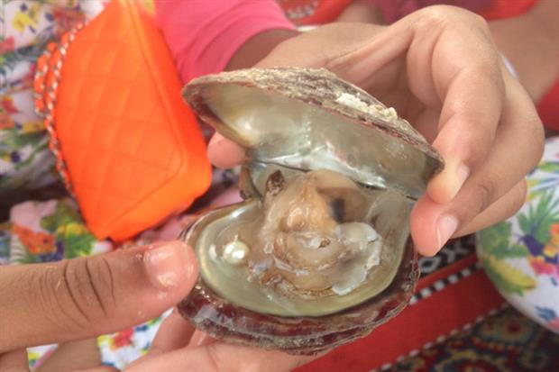
spread to the slightly drier and cooler highlands in the South. The Dahlak Archipelago, consisting of two
large islands and 124 smaller ones in the Red Sea, are the sites of ample
fishing, pearl diving, and eco-tourism. Pearl fisheries in the Red Sea have
been famous since the Roman Empire was around. (Only about four of these islands are inhabited.) A few years ago, Eritrea announced that
it was going to place all of the coastal regions and all 350 islands it controls
under environmental protection, the first country to do so.
The
ancient Egyptians likely included Eritrea as part of the land called Punt. It
was later called D’mt (sometimes written as Damot) and was known for their
advances in agriculture and development of iron tools and weapons. Some
scientists also believe this area is home to some of the oldest human bones
ever found, the cradle of civilization. Throughout the centuries, the people
living in what is now Eritrea have been invaded from all sides: southern
Arabians (probably from Yemen), the Ottomans, the Portuguese from Goa (in
India), the Italians, and the British. Toward the end of the 19th
century, the Italians took control of the area (along with Ethiopia and part of
Italian Somaliland) and renamed it Italian East Africa. However, the British kicked the Italians
out during the beginning of WWII and took over. Eritrea was counted as one of Ethiopia’s provinces so that
Ethiopia would have access to the Red Sea; however, tensions between the two
countries grew until they entered into a 30-year war resulting in Eritrea
gained its independence in 1991. Even today, tensions are still shaky between
the two countries.
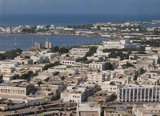
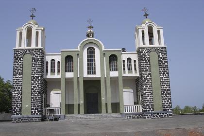
The
capital of Asmara, also known as Asmera by the locals, lies in the middle of
the country. Originally a Tigrinya
and Tigre settlement dating back to around 800BC, it’s become known for its
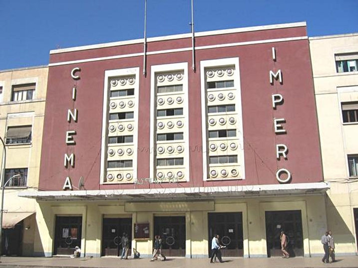
Italian architecture left over and preserved from the colonial days, many utilizing the art deco style. The city is modern in almost every
sense: from contemporary public art and architecture to museums, sports arenas,
shopping, higher education, and the arts.
.jpg)
Recently,
Eritrea’s economy has seen a significant jump, mostly based on its gold and
silver mining industry as well as cement manufacturing. Years of war has taken
its toll on the economy with a decline in able workers killed in action as well
as inadequate and destroyed infrastructure from the resulting damages. However, even during the war, they did
their best at maintaining certain aspects of infrastructure: paving roads,
bridge repair, etc. They do have
their own railway and airlines, but it’s not yet reliable; service is
infrequent and sporadic.

While
technically there’s not actually an established official language, the local
language most widely spoken and used as a de facto national language is
Tigrinya. Tigre and Dahlik are
also used in certain areas of the country. Arabic is also listed as a de facto national language
because of its proximity and relationship to Arabian countries. English is used
as a working language and taught in schools along with Italian, which many
people can still speak and understand.
The vast
majority of people in Eritrea follow Christianity, followed by Islam, but the
percentage of followers vary.
Eritrea only allows people to adhere to specific sects of these
religions. For Christianity, you
must be part of the follow: Eritrean Orthodox Tewahedo Church, Catholicism, and
the Evangelical Lutheran Church; and for Islam, it must be Sunni. You have to register for any other
denomination. If your sect is deemed too radical (Jehovah’s Witnesses, Bahá’í,
Seventh Day Adventist, and many others), then you cannot practice freely. If
you are caught practicing an unregistered religion in private, you can be
imprisoned for an indefinite amount of time.
Along with
this idea, media freedom places Eritrea at the bottom of the list in comparison
with all other countries in the world. It’s the only African country to have no
privately-owned news media – whether it be in print, radio, or television. There are absolutely no foreign
journalists living in the capital since the ban of independent news agencies in
2001. The only news comes from the single-party state-owned news agency, only
telling you what they deem is important.

One
interesting (yet sad) thing I read was that during the Ptolemaic times of
ancient Egypt, they used to keep hundreds upon hundreds of elephants in Eritrea
in reserve for times of war.
However, during the latter half of the 20th century, no one
saw a single elephant in the wild.
Many think they were either killed from the Ethiopian-Eritrean war or
fled elsewhere because of the war.
(A herd of about thirty were spotted in 2001, and it’s believed that the
elephant population may be around a hundred now.) Another thing I read is that the port city of Massawa
literally means “shout really loudly.” I’m always interested in interesting
city names and their literal translations. (I just found out recentlly that Brazil has a city named
Não-Me-Toque, or Don’t Touch Me.)

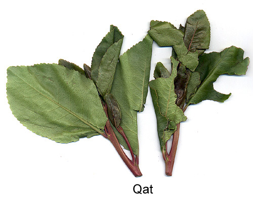
I’ve found
my recipes – the food sounds spicily amazing. I know I’m going to love it. My family, on the other hand, will
probably be plotting to bury me alive.
There’s a lot that I don’t know about Eritrea, but I’m really excited to
find out more. I have a feeling that there are some really cool things here.

Up next:
holidays and celebrations