So I made some amendments to the childhood tongue twister: She sells seashells from Seychelles down by the seashore made of sea shale. Try saying that a few times fast. (Now try it after a few drinks.) The only things I knew about the Seychelles were that they were near Africa in the Indian Ocean, and that I had read somewhere they were a popular destination for the rich and famous to spend their free time. And they have an odd double coconut.

These
islands were pretty much uninhabited, so there really isn’t a native name. The
Portuguese called them the Amirantes. But it was the French who named them
after their Minister of Finance to Louis XV, Jean Moreau de Séchelles. From
what I gathered, the guy really didn’t do all that much for the Seychelles Islands,
so they probably just owed him a favor or something.
The
Seychelles Islands are located roughly 950 miles east of Kenya in the Indian
Ocean. This 115-island nation is northeast of Madagascar and the Comoros
Islands, north of Mauritius, and southwest of the Maldives. Some of the islands
are granite-based and others are coral-based. Understandably because of its
location and proximity to the equator, the Seychelles Islands are humid and
tropical. July and August are the
cooler months of the year whereas the heat and humidity tend to be higher from
December through April.

Although the
islands weren’t readily inhabited, it’s also reasonable to think that sailors
from the Maldives and the Arabian Peninsula probably visited the area. After
the Portuguese arrived, the British showed up, and then the French. And there
were a fair number of pirates who used the islands as a pit stop between Africa
and Asia. However, the British moved back into the area and took control of the
islands in 1794. The British and the French decided to work it out among
themselves, and the British gains included adding the Seychelles Islands in
with the Mauritius Islands, known as British Mauritius. In 1903, Seychelles
separated itself from Mauritius and became a crown colony. They actually held
their own elections just prior to their independence in 1976. It quickly became
known as the place where the rich and famous go to play. However, there was a
coup in 1977 and the new president warned about too much tourism and then put
into place a strict one-party socialist system that lasted until 1991. The
1980s brought a number of coup attempts. But once they got rid of that mess,
they approved a new constitution and tried to start over. In 2013, the
Seychelles Islands were devastated by flooding from a tropical cyclone that tore through the islands
causing quite a bit of damages.
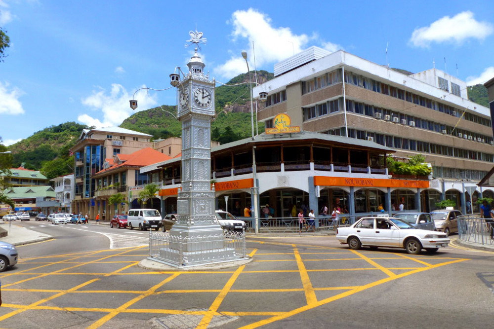
The capital
city of Victoria is found on the island of Mahé. Originally established by the
British as the capital of its colonial government, the British gave it its current
name after acquiring it from the French. With roughly 26,000 people in the
greater capital area, there are several places of note they’re known for: their
botanical gardens, their large fruit and fish market, a national stadium, a
clock tower built after the Vauxhall Clocktower in London, and a couple national
museums.
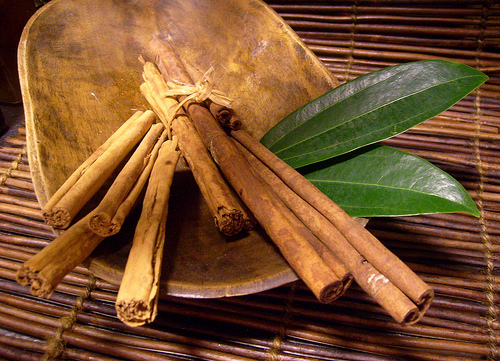
Seychelles’s
economy is similar that of other island nations. Their major agricultural
products include fish (both fresh and frozen), vanilla, sweet potatoes,
cinnamon, and copra (dried coconut meat or kernels used to make coconut oil).
There have been some efforts in recent years to really ramp up their tourism
with more beach resort hotels and restaurants.

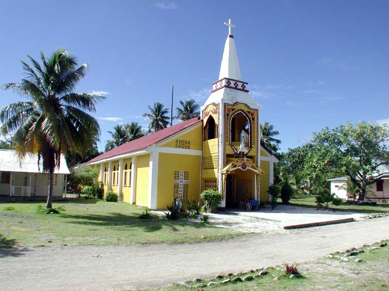
The vast
majority of Seychellois are Christian, with most of them following Roman Catholicism.
The main Protestant denominations represented in the islands include Anglican,
Pentecostal Assembly, Seventh-Day Adventist, and others. Because of
Seychelles’s proximity and history with Arabs and Indians, there are also
pockets of Hindus and Muslims as well. And surprisingly, there are a
significant number of atheists and agnostics there.

While
English and French remain as official languages from their colonial days,
Seychellois Creole is also listed as an official language and spoken by most of
the people there. Seychellois is a French-based Creole with a number of English
words mixed in.
 |
| Miss Seychelles 2008, Elena Angione |
So, I was
reading about how their society is essentially a matriarchal one when it comes
to taking care of the household and raising the children. In fact, unwed
mothers do not share the same stigma that they do in the US. However, outside
of the home, a woman’s status only goes so far. Sexual harassment, domestic
abuse and rape, and discrimination still regularly occur, and the problem is
that those in authority to do something about it often look the other way. Numerous studies have shown that giving
women access to education and equal job and housing opportunities are shown to
help reduce poverty. This is why we need feminism.
Up next: art
and literature