Showing posts with label South Pacific. Show all posts

Sunday, April 15, 2018

SAMOA: THE LAND AND THE PEOPLE


When I was trying to find recipes for Samoa, I was surprised to find a ton of recipes for desserts based on the Girl Scouts cookie called Samoas. And that was entirely NOT what I was going for, although they are delicious. And the other part was that now there are two Samoas: the island nation of Samoa (I grew up calling it Western Samoa) and American Samoa (a US territory – for more information on this and other US territories, please watch John Oliver’s segment he did on this on his show).


The name Samoa most likely comes from the Samoan words sa meaning “sacred” and moa, meaning “center.” There may be other theories out there, but I couldn’t find anything substantial.


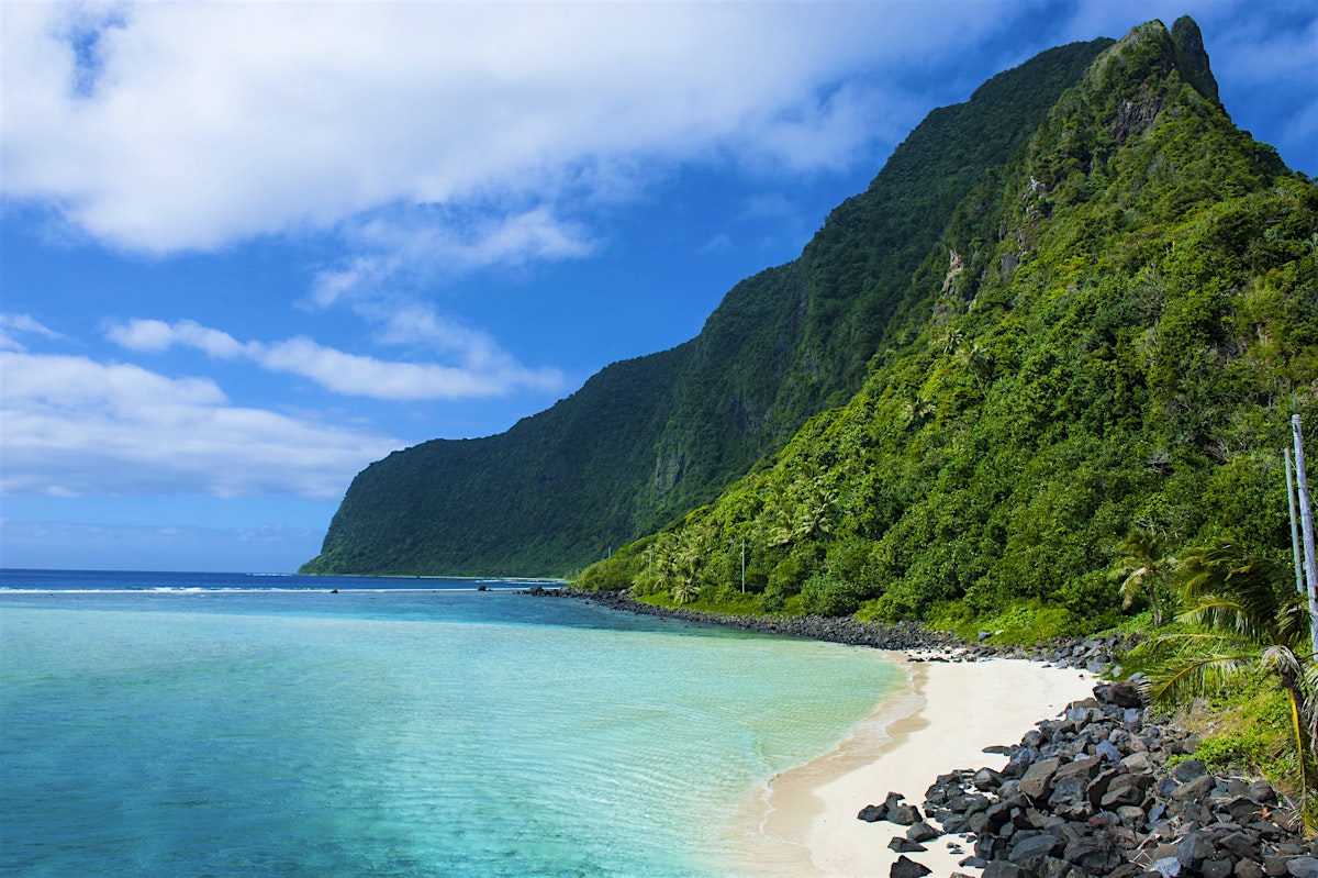
This island nation is located in the south Pacific. It’s slightly northwest of the island of Niue, south of Tokelau, and east of Wallis & Fortuna (belonging to France). There are two main islands (Savai’i and Upolu) along with four smaller islands. The US territory of American Samoa lies southeast of Upolu (American Samoa itself actually refers to five main islands and two atolls.). The climate here is tropical, with a rainy season that lasts from November to April. The islands used to be covered in lowland tropical rainforests, but nearly 80% of those have been lost.


It’s believed that Samoans landed on these islands nearly 3000 years ago, but from where exactly, it’s still somewhat disputed. They share cultures, languages, and genetics with other nearby islands (namely Fiji and Tonga). The Dutch were the first to arrive in 1722, followed by the French in 1768. English missionaries (through the London Missionary Service) and other traders began making their way to the islands during the 1830s. However, the Germans looked upon the islands with more of a commercial purpose in mind, mainly with copra (dried coconut meat) and cocoa production. At the same time, the US started taking interests in the eastern islands as a territory, and several became known as American Samoa. The Samoans entered a civil war, and the British, Germans, and US each began sending in ships to protect and control their interests. A storm hit and destroyed most of the ships, ending the conflict; they signed an agreement giving the eastern islands to the US (American Samoa) and the western side to Germany (German Samoa). During the German’s 14-year rule, an uprising took place. The response was to banish the leader of the uprising to the German-held Northern Mariana Islands. New Zealand then controlled the islands from WWI to 1962, when they became known as Western Samoa. They were hit hard by the global influenza epidemic of 1918-1919 (I didn’t fully realize how widespread this epidemic was). The Samoans weren’t really happy with New Zealand’s control either, and there were several uprisings, some ending tragically for the Samoans. In 1962, they finally gained their independence, making them the first small-island nation in the Pacific to do so. In 1997, they voted to change their name from Western Samoa to just Samoa (something American Samoa wasn’t happy with apparently, thinking it would be confusing and diminishing their own identity).


Located on the northern coast of the island of Upolu, the city of Apia serves as its capital and largest city. Historically, the city also served as the capital of German Samoa as well. It serves as the center of the government as well as center for most other services (financial, education, media, transportation, etc.). The Scottish writer Robert Louis Stevenson lived out his final years in Apia. The winters are probably WAY better than in Scotland.


Samoa is an economically developing country. Agriculture is still a top exporter, especially in taro root, bananas, cocoa, noni, copra, and coconut cream/coconut oil. There has been some investment in expanding the financial sector along with tourism.


Because of Samoa’s history of being controlled by Christian-dominant countries, it’s no wonder that Christianity has a strong stake here still. The largest denomination is the Christian Congregational Church of Samoa, followed by Roman Catholic and Methodist and several others. Despite the fact that Samoa’s constitution declares Samoa as a Christian nation (a change made only last year), there is also a sizable number of Baha’i followers.


English is the official language along with Samoan (known as Gagana Fa’asamoa). There are actually more Samoan speakers (including second-language learners) than English speakers. Samoan is similar to other Polynesian languages like Hawaiian, Tongan, Maori, Tahitian, and Rapanui. And there is also Samoan Sign Language for the deaf community and a Samoan Braille as well. 


Two things I read about caught my attention: in 2009, Samoa switched to driving on left, something they felt aligned them with other countries in the world. I always wondered what that process looks like in logistically getting everyone to switch over. I just imagine a lot of head-on collisions during the first couple of months. Another thing that amazed me was that in 2011, they moved the International Date Line so that they were in line with Australia and New Zealand. Previously they were 21 hours behind Sydney, the result of being set up in the 1890s to work with Californian businesses. Now, realizing they have much stronger economic ties to Australia and New Zealand, they are only ahead of them by three hours. It certainly makes a lot more sense.

Up next: art and literature

Sunday, December 25, 2016

NAURU: THE LAND AND THE PEOPLE


I’m going to bet most people have never heard of the third smallest country in the world. In fact, I’ll admit that even I wasn’t exactly sure of the correct pronunciation of this tiny island in the South Pacific. Nauru (pronounced na-OO-roo) is pretty much isolated. Unlike other island countries in this part of the world, Nauru is all by itself – a one-island country. So, what’s so special about one island poking its nose out of the ocean? Plenty.

 
Historians aren’t exactly sure where the name Nauru came from, but the most accepted origin is that it’s derived from the Nauruan word for “I go to the beach.” When the British arrived in the late 1790s, they referred to the island as Pleasant Island. 


Nauru is located in the Micronesian group of islands. Its nearest neighbor is the island of Banaba Island (part of Kiribati), located almost due east. The Marshall Islands are to the northeast, and the island of Kosrae (Federated States of Micronesia) lies to the northwest. A little farther away still to the southwest are the Solomon Islands and the islands of Tuvalu are to the southeast. This island is one of the few islands in the South Pacific that is known for its phosphate deposits. Because Nauru is close to the equator, the climate tends to be warm all year round. They generally see a rainier season (with monsoons) between November and February.


Nearly 3000 years ago, groups of Micronesians and Polynesians moved to the island. There were originally 12 tribes on this island (which is why there’s a 12-point star on their flag). Life went on in their own ways of living off the ocean and what the island provided until the Europeans arrived. The British whale hunter and sea captain John Fearn was the first European to step foot on the island in 1798 and named it Pleasant Island. They began to regularly trade with the islanders, especially in palm wine and firearms. In 1888, Germany took the island in as part of the Marshall Islands Protectorate. At the same time, Christian missionaries began arriving from the Gilbert Islands (now Kiribati). The Germans stayed there for almost 30 years. During that time, phosphate was discovered on the island, and it didn’t take all that long before they figured out how to exploit the reserve. During WWI, Nauru was captured by the Australians. Australia, New Zealand, and the UK came together to administer the island and establish an organization to handle the phosphate business. In 1940, the Germans bombed five supply ships and the phosphate mines and other key operations on the island. Two years later, the Japanese invaded and took over the island, removing a number of Nauruans to the Chuuk Islands (Federated States of Micronesia). By the end of the war, the Japanese surrendered it back to the Australians. So, although Australia was the one who administered the island, it was actually divided up between Australia, New Zealand, and the UK. During the mid-1960s, Nauru began working toward self-governance and finally gained independence in 1968. They purchased the phosphate mines for their own, which helped them to have one of the highest standards of living among the islands of the South Pacific. 


Nauru is one of the few countries that doesn’t have an official capital. The de facto capital—where the center of government is—is the city of Yaren. Located in the southern part of the island, the city used to be called Moqua. I thought that I grew up in a small town, but this “capital” city is smaller than my hometown: Yaren has 747 people whereas Morgantown, Indiana has about 986 people.  


For a long time, the Nauruan economy was based on the phosphate mines. There really aren’t many other natural resources on the island, and they have to import many of their supplies, materials, and food. A trust was formed between UK, Australia, and New Zealand to manage the mines, and part of that included long-term investments. Mismanagement caused them to renege, and this forced them to scrounge to fix their debts. Unemployment is really high, and the vast majority of those employed work for the government. During the 1990s, they were a tax haven and actually weren’t all that cooperative in curbing this problem. Now many people work for an Australian immigration detention facility located on Nauru. This facility has gotten the attention of the international community for its deplorable conditions and riots. Because of the ties with Australia, Nauru uses Australian dollars as their currency.


Most people practice Christianity; there are more Protestants than Roman Catholics, but there are also a number of other denominations represented here as well. Nauru has the largest proportion of Baha’is in the world (10%). There are also smaller communities of Buddhists and Muslims as well. In their indigenous beliefs, their main deity was a female by the name of Eijebong.  


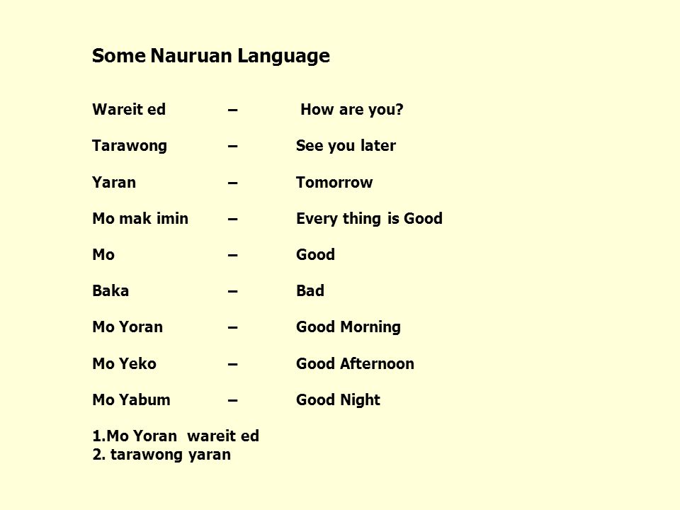
The official language is Nauruan. Nearly 96% of the people speak Nauruan in the home. Nauruan is a Micronesian language, but it’s not exactly clear how closely tied Nauruan is to other Micronesian languages. Their language also has many German and Latin loanwords. Because of their ties with Australia, English is also widely spoken on the island and tends to be the language of the government and commerce. 


Besides having a matriarchal society in their traditional culture, there are a number of interesting things about this tiny island. For one, they are the smallest country—both in area and in population—in the UN. However, despite its small size, Nauru is listed as one of the Fattest Nations in the World. (I’m hoping that means the food is good?) It’s also one of the least visited countries in the world, receiving around 200 visitors per year. Well, let’s try to put it on the map.

Up next: art and literature

Sunday, August 21, 2016

MICRONESIA: THE LAND AND THE PEOPLE


When I was a kid growing up in the 1980s, I was fascinated by this world atlas book my mom had. It not only showed regions of countries but it gave an overview of the area with some basic stats. It also had wonderful photos of each area with captions. I must’ve read it a million times. I distinctly remember looking at the Federated States of Micronesia and being in awe of the world’s newest country. I was six years old at the time, and now thirty years later, I’m finally coming around to Micronesia again.

 
The country called Federated States of Micronesia is named after the region of Micronesia. Micronesia, from the Greek words meaning small (mikrós) and islands (nêsos), was most notably called by this name by the French explorer Jules Dumont d’Urville in 1832 (it was probably called this by others before him, but alas, d’Urville has taken all the credit). The region of Micronesia consists of several island groups and nations including the countries of Federated States of Micronesia, Marshall Islands, Kiribati, Palau, Nauru, Wake Island, Guam, and the Northern Mariana Islands (the last three being US territories). To make matters more confusing, the country of the Federated States of Micronesia are often just shortened to Micronesia (and from this point forward, when I use the term Micronesia, I’m referring to the country unless otherwise specified). Now you can impress your friends by telling them all about the difference between the REGION of Micronesia and the COUNTRY of (the Federated States of) Micronesia. 


The islands of Micronesia are located in the South Pacific just west of the Marshall Islands, northwest of Nauru, northeast of Papua New Guinea, and southeast of Guam and the Northern Marianas. The country consists of 607 islands divided into four states: Yap, Chuuk, Pohnpei (not to be confused with the ancient Italian city of Pompeii that was destroyed by the volcano Mt. Vesuvius), and Kosrae. The islands itself can range from mountainous to low coral atolls. Because these islands are in the South Pacific, they enjoy a tropical climate. They do experience heavy rainfall pretty much all year long, especially the farther east you go. They’re also likely to be hit by typhoons since they’re located along the edge of the typhoon belt (I didn’t even know this is a thing—I guess it’s the equivalent to tornado alley). 


People started moving into this group of islands about four thousand years ago. Early cultures centered around the island of Yap, on the western part of the chain. The Portuguese were the first Europeans to arrive, followed by the Spanish, who included these islands as part of their holdings in the area. The Spanish sold the islands to Germany at the end of the 19th century, which they included as part of their German New Guinea. Japan took it over during WWII; the Japanese fleet was based in the Truk Lagoon, the site of a major battle that destroyed many of the Japanese naval vessels. However, Japan was forced to relinquish the islands as a South Pacific Mandate after the war. The US administered the islands in 1947 as a Trust Territory through the United Nations. In 1979, four of the states decided to band together to form the Federated States of Micronesia, and the Marshall Islands, Northern Marianas, and Palau chose not to join. In 1986, they officially gained their independence. The Trusteeship officially ended in 1990, but they continue to have a free association with the United States. 

Palikir
The capital city of Palikir is located on the island of Pohnpei. It’s about 6 miles from the city of Kolonia, Pohnpei’s largest city and capital of the state of Pohnpei. Both cities are located on the northwest coast of the island. The city is the center for commerce and the government. There are several artificial islands nearby called Nan Madol and nicknamed “the Venice of the Pacific.” It’s the site of the 1000-yr old ruins of an ancient city, a network of roughly 100 artificial islets made of stone and coral. Palikir is also a popular spot for surfing, diving, and snorkeling. 


Micronesia depends mostly on farming and fishing, especially tuna. It’s not strong in mining, except perhaps for high-grade phosphate. They do have a sizeable tourism industry, and they also highly depend upon financial assistance from the US. Because of its dependence and ties to the US, US currency is used in Micronesia. They are also known for having the largest coins in the history of the world: the Rai stone looks kind of like a large stone doughnut. The largest is about 12’ by 1.5’ and weighs roughly 8800 lbs. Because they’re too large to move (obviously), it’s basically just verbally transferring ownership to the next person. 


The majority of the population is Roman Catholic. There is also a sizable Protestant population as well, and the percentages definitely depend on the island where some are more than others. There are also a small number of Buddhists (probably left over from the Japanese occupation) and some Baha’i as well. 


English is the official language of Micronesia. However, there are several other indigenous languages that are also spoken here as well. Each island has its own language (although I’m not sure of how mutually intelligible each language is): Chuukese (spoken on Chuuk, Pohnpei, and Guam), Kosraean (spoken on Kosrae, Nauru, and Caroline Islands), Pohnpeian (spoken on Pohnpei and the Caroline Islands), and Yapese (spoken on Yap). 

Nan Madol
I knew from looking at a map that these islands were small, but I read that in total, they only equal 271 sq mi (almost the same land area as the city of Lexington, KY). But to get a better sense of how spread out these islands are, these 607 islands are spread across a little over a million sq mi of water! Another thing I learned is that each state does its own customs, so if you are island hopping, you can pretty much expect the same level of scrutiny in each main island. However, the weather is generally nice all year long, and there are practically no tropical diseases. I’m already wondering if my job would let me work from home from Palikir?? Probably not.

Up next: art and literature

Sunday, September 13, 2015

KIRIBATI: THE LAND AND THE PEOPLE


There are just some countries that are more known than others. This one gained its independence the year I was born. However, we’re both about as equally known. (Ok, maybe Kiribati has a slight leg up on me.) Regardless, many people—and especially Americans—have barely heard of this country, much less even know what side of the world it is in. Heck, even I had to look up the correct way to pronounce it (it’s “KEER-uh-bahss” if you were wondering). And because of this, it’s one of the few countries that have given me trouble in finding information about its culture and recipes. It’s the second country I have had trouble finding a bread recipe for (Bhutan was the other). On the other hand, essentially everything I learned about this country was new information. 


The name Kiribati is their local pronunciation of the word Gilberts, which is what the British named these islands when they controlled the island group. (The “ti” sounds like “s” in the local language.) Kiribati is located in the South Pacific (or sometimes called Oceanea). It consists of 33 atolls (ring-shaped islands usually made of reef or coral) and reef islands and one raised coral island (the island of Banaba is the only true island in this country). The islands of Western Samoa, American Samoa, Fiji, Tonga are to the south; Tuvalu and Vanuatu are to the southwest; Nauru is to the west; Federated States of Micronesia and Marshall Islands are to the northwest. And the Line Islands (the eastern end of Kiribati) are a little over 1300 miles due south of the Hawaiian Islands. The equator and the International Date Line runs through Kiribati, even though they petitioned to have the date line moved so that the Line Islands can be on the same date as the rest of the country (the Phoenix Islands and the Gilbert Islands ). They enjoy a tropical climate with a rainy season between November and March and a dry season between April and October. Because of the soil makeup, there are limitations on the numbers and kinds of plants and animals that live here. 


Originally, the people living on these islands were Micronesians who had explored eastward and settled here. Other islands in this area (Fiji, Tonga, etc.) also moved (rather, invaded) this area as well. Eventually, they stopped fighting each other and had makeup intermarriage, and after centuries of this, the ethnicity of all of these island groups began to merge. Europeans had major explorations throughout the 17th and 18th centuries, and several of these ships happened to sail past these islands by chance and just stayed. The British eventually took control of these islands and named them the Gilbert Islands after the British captain, Thomas Gilbert. They in turn added in more islands to their holdings, and it became the Gilbert & Ellice Islands as it advanced to crown colony level. (The Ellice Islands became Tuvalu a year before Kiribati gained its independence.) Early during WWII, the Japanese occupied the Tarawa Atoll until the US Marines arrived and told them to get out (more or less, with the only way they knew how to). During the 1950s and 1960s, the US and UK used Christmas Island (also spelled Kiritimati—remember “ti” says “s” in the Gilbertese language) as a testing grounds for nuclear weapons. In July 1979 (a few months before I was born), the Gilbert Islands gained their independence and became known as the Republic of Kiribati to the rest of the world. The people became known as the I-Kiribati. About ten years into their independence, they began to address problems of overcrowding by making people move to other lesser-populated islands. In recent years, the government of Kiribati has been quite vocal about the effects of climate change, especially since two islands were lost in 1999 due to rising sea levels. In fact, they have even started asking other nearby countries to accept their people as refugees due to climate change. Some climate scientists predict that the island nation could be swallowed by the sea within the next 60 years. Other people aren’t so sure on the timeline. It’s certainly a cause for debate. But if you doubt climate change, talk to some of the people who are directly impacted by its effects here. 


The capital is located on the Tarawa Atoll, most widely known for the Battle of Tarawa during WWII, which left over 6000 Japanese and Americans dead at the end of the day. Essentially, the island is divided between South Tarawa and North Tarawa. Causeways have been built to get between the islets. The actual governmental buildings are located on South Tarawa, along with other vital business, financial, and the few higher educational institutions they do have. 


Kiribati’s soil makeup along with the fact that the country is made of reef islands means there are very few natural resources and is thus one of the poorest countries in the world. It’s also one of the least developed. There is an important fishing industry that keeps Kiribati’s economy alive along with some tourism dollars added in there. They also depend of some minor agricultural production as well, mostly in copra, breadfruit, sweet potatoes, taro, and various vegetables. However, the country has to depend quite a bit on developmental assistance from other countries and organizations.


Because Kiribati was controlled by the British for so long, the dominant religion is Roman Catholicism, although the Kiribati Uniting Church maintains a fairly substantial number of practitioners. You’ll also find a number of Protestant faiths as well as Bahá’í and the Church of Jesus Christ of Latter-day Saints. 


English is listed as an official language along with the local dialect called Gilbertese (which is written in Roman letters). English is pretty much only used on the largest island of Tarawa and often used as part of code mixing (mixing the two languages) on the other islands. Gilbertese is interesting to me because it is a verb-object-subject language (in comparison, English and Romance languages are subject-verb-object languages.) There are only a few other languages who fall in this category, namely Malagasy (spoken on Madagascar and Comoros), a few languages in Indonesia, Fijian, and Mayan languages. There are actually Gilbertese speakers not only in Kiribati but also on Fiji, Solomon Islands, and Tuvalu. 


I have a feeling this country is going to be a challenge just because there is limited information on some of the things larger countries have readily available. Like, by now I usually have found at least one or two albums to put in my Spotify playlist. But not so for Kiribati. I have nothing there. Usually, I have been able to find at least one recipe for a bread or cake or pastry or even a mention of this. But not so for Kiribati. (I had to expand out to Micronesia since many I-Kiribati are ethnically Micronesian. And I’m still surprised that for a country that was controlled by the British for so long that there are no bread, cake, or pastry recipes posted online anywhere? I’m still looking, but still… Sheesh.) So, it will certainly be a research challenge, but I’m up for it but have my backups ready.


Up next: art and literature

Sunday, July 6, 2014

FIJI: THE LAND AND THE PEOPLE


Far, far away from Indianapolis, there is a place where the perfect panorama of calendar photos and screensavers are born.  It’s the place for lovers and those in search of ultimate relaxation; it’s the view of luxury.  To visit Fiji is to live the high life. But the island nation in the South Pacific is more than a pretty beach. Even though I think I need to go there and investigate this myself.

Where the name Fiji came from made me roll my eyes. The word isn’t Fijian at all.  They call their country Viti in their own language.  The word “Fiji” came from the English pronunciation of Fisi, the name for the islands that their neighbor Tonga gives them. 
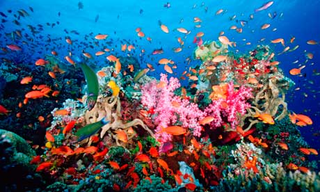
Fiji actually consists of 322 islands (of those, 106 are inhabited), and they also include 522 smaller islets.  The largest two are Viti Levu (where the capital city Suva is) and Vanua Levu.  Most of the islands are spread in the same general vicinity, with the exception of the island of Rotuma, a special administrative region, which lies about 310 miles north of the main islands. The average temperature in the cool season stays around 72ºF. (This sounds absolutely perfect. I wonder if I can “work from home” from Fiji.) It’s home to many coral reefs and a wide variety of marine life.

Pottery found on the islands dates settlement between 3500-1000 BC, although it’s not exactly clear the order of migration.  Some historians believe the Lupita peoples, or early ancestors to the Polynesians may have been the first inhabitants on the islands; it’s also believed that the Melanesians were the second major group of people to land on the islands before moving on farther to Samoa, Tonga, and even Hawai’i.  Most of the islands in the South Pacific have been trading with each other from the beginning of civilization.  During the 19th century, stories of cannibalism and fierce tribes kept many of the European steering clear of the Fijian islands. One of the most macabre characters from history is the chief Ratu Udre Udre.  He’s considered by the Guinness Book of World Records to be the “most prolific cannibal.” It’s been noted that he has consumed between 872-999 people, keeping a stone for each person he ate. He was under the influence of the crazy idea that if he consumed his 1000th person, he would gain immortality.  (And who’s going to tell him otherwise? If you did, you’d probably be helping his cause.) It wasn’t until Abel Tasman (yes, the same guy who discovered Tasmania Island and New Zealand) set sight on Fiji in 1643, although he never actually landed there.  Most of the Europeans who landed here were missionaries, whalers, and those who were in the sandalwood trade and sea cucumber trade (apparently, there was such a thing). Eventually, the warring tribes ceased under the leadership of the chief Ratu Seru Epenisa Cakobau. The British then took over the islands in 1874, bringing over laborers from India to work the sugar plantations.  However, they also brought on a measles epidemic that wiped out nearly 40,000 Fijians (about one-third of the population at that time). Fiji was granted their independence from Britain in 1970, and since then, suffered through two military coups in 1987, another in 2000, and a fourth one in 2006. 

The capital city of this island country is Suva, on the southeast coast of the main island of Viti Levu.  Even though it is the capital, it’s not the largest city; that would be nearby Nasinu.  Suva is not only home to the nation’s political and administrative districts, but the larger metropolitan area is home to many of the nation’s top universities and colleges, business districts, shopping centers, and sports arenas.  In fact, Suva has hosted the South Pacific Games three times in the forty years it has been running.  The city itself is multiracial and multicultural, as is most of the country. Museums, libraries, parks, and theatres dot themselves across the city as well.  In 1953, Suva suffered through the most devastating earthquake in its history.  The 6.75 earthquake killed eight people and caused nearly a half-million dollars in damage (1953 figures in US dollars).

Fiji has an abundance of forest, fish, and mineral resources making it one of the most productive economies in the South Pacific.  The sugar industry is one of the nation’s leading industries; they are number two in receiving sugar subsidies in the world (after Mauritius).  The islands are also dependent on tourism.  Resorts and local transportation are also dependent on the tourism boom. Trade, international banking, investment, and housing are growing, but it’s still a criticized sector of the economy, especially under the rule of a military government.

A large portion of Fijians is Christian, thanks to the British influence. This is probably one of the few countries where the Methodist Church is the largest denomination.  Other denominations include Roman Catholic, Assembly of God, Seventh-Day Adventist, The Church of Jesus Christ of the Latter-Day Saints, and the Anglican Church. Of the Indo-Fijians, most are either Hindu or Muslim with a small portion of Christians.  Of those who practice Hinduism, most are of the Sanatan sect with a small number of followers of Arya Samaj sect. The vast majority of Muslims are Sunnis. Baha’i and Jewish populations are also minutely represented in Fiji as well.
Bula = Hello
The Fijian language is the official language of Fiji.  English and Fiji Hindi also have official status as well. Fijian is a part of the Malayo-Polynesian family of languages, and while there are many dialects, Standard Fijian is based on Bau, an island in the eastern region.

Professional golfer and champion Vijay Singh was born and raised in Fiji (he’s of Indo-Fijian background, although he lives in Florida now). Nalini Krishan is another famous Fijian – she played the character Bariss Offee from the Star Wars movies Attack of the Clones and Revenge of the Sith.  It’s hard to recognize her because of all the make-up.  Rugby is huge in Fiji. And by that, I mean, some ten percent of the population plays rugby and the others watch. Years ago, I was making my way through the American Film Institute’s “100 Years…100 Movies” list (the 1998 version).  Number 86 on that list was the 1935 film Mutiny on the Bounty.  While the movie is criticized for it’s historical inaccuracies, it’s been said that after Captain Bligh and 18 of his men were set adrift by the mutineers in 1789 off the coast of Tahiti, they drifted into Fijian waters and narrowly escaped Fijian war canoes. The International Date line runs just to the right of the island group, and was angled to include most of the islands; however, it does runs through the middle of the island of Taveuni – at one point, you can put one foot in today and one foot in yesterday.  And yes, Fiji Water, one of the most expensive bottled waters I’ve ever purchased, is actually water from Fiji. So, grab your Fiji Water, if your bank account allows, and follow me to Fiji (I wish that were a literal statement; well, ok, no I don't. I don't want EVERYONE to go with me. I'm way too introverted for that. Just keep reading, ok?).

Up next: holidays and celebrations