Showing posts with label eastern Africa. Show all posts

Sunday, August 30, 2015

KENYA: THE LAND AND THE PEOPLE


When my mother-in-law passed away, I learned a lot of things about her that I didn’t know while she was living. During the first days after her death, my husband and his sisters would tell stories of her life, several that I had never heard before. One of the things I learned was that she was named after the small town of Taveta, Kenya, located about 5 km (about 3 mi) from the southern border with Tanzania near Lake Jipe. It’s also between Tsavo West National Park in Kenya and Mt. Kilimanjaro National Park in Tanzania. One day, I would love to take my kids there to show them one side of their family heritage (I’m assuming at least part of her heritage was from this area since she was named after this super small town, but we all know how well records were kept during the slave trade, so who knows? 


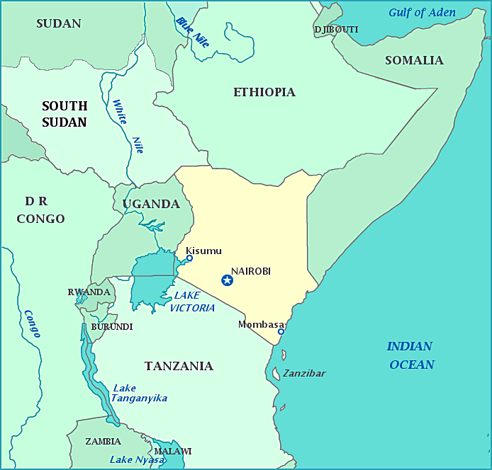
The country of Kenya was named after Mt. Kenya, or rather the Kamba name for the mountain. Mt. Kenya is actually an extinct volcano. It was later Anglicized as Mt. Kenia and later as Mt. Kenya. Kenya lies in eastern Africa, surrounded by Ethiopia to the north, Somalia to the northeast, the Indian Ocean to the southeast, Tanzania to the south, Uganda to the west, and South Sudan to the northwest. Besides the Indian Ocean, there are several large lakes spread throughout the country, most notably Lake Victoria and Lake Turkana. One of the great things about this country is that if you look at a map, the country is mottled with green areas denoting national parks. I always have to have a respect a place that sees the importance of retaining its green areas and natural ecology. Kenya sits in the middle of the Great Rift Valley with the deepest portion just north of Nairobi. The equator practically cuts through the middle of the country. Their climate is generally tropical, but it gets more arid and desert-like the further to the north and northeast you go. Generally, they have a long rainy season in the spring and a short rainy season  in the fall and winter months. 


Kenya is the site of some of the oldest human remains in the world. It’s no wonder that people often say this is the birthplace of civilization. In fact, the Richard Dawkins Foundation for Reason and Science sells shirts saying “We Are All Africans,” stemming from this idea. The first peoples here were nomadic, generally related to Khoisan and Cushitic peoples. Nilotic groups such as the Maasai, Luo, and Turkana began to move into the area from Sudanese lands. Bantu groups like the Kikuyu and the Kamba also began to move here as well. During the first century, Arab traders began spreading into this area, and their presence changed its culture. Islam spread because of this and so did the Swahili language. The port cities of Kenya became very popular places and were the most progressive and bustling areas of the country. During the late 1800s, the British took control of the land, renaming it British East Africa. One of the first things they did was build a railroad (as they did most places they took over). It was the British who called their colony Kenya. During the 20th century, European farmers got rich farming coffee and tea, especially in the central highlands. Kenyan coffee is fairly well known around the world. During the 1950s, there was an uprising against the British being there, and Kenya finally won their independence in 1963. Their first president, Jomo Kenyatta, was instrumental in moving the country into this new realm. There have been several presidents since then, and several coup attempts along with corruption scandals. The current president is Uhuru Kenyatta, the son of Jomo Kenyatta. 


The capital and largest city in Kenya is Nairobi. Nairobi is stemmed from a Maasai phrase meaning “cool water.” One thing that makes the city stand out is that there is a game preserve inside city limits—the only major city to have one. The city not only stands as the center of government but also as the center for education with several universities and technical schools, shopping districts and markets, sports arenas (including Africa’s largest ice rink), financial centers, parks, theatres, museums, and a growing restaurant/culinary scene.


Kenya’s low ranking on the human development index somewhat negates the fact that they have one of the strongest economies in the region. Recent droughts have plagued the northern regions of the country, and this alone has had a direct effect on their economy. There was a food shortage and schools had to close, forcing Kenya to appeal to humanitarian and foreign aid. However, Kenya has seen an increase in tourism (especially ecotourism), telecommunications, and higher education. Agriculture remains to be an important part of their economy, and they are in the process of recovering from the drought years. Products such as coffee, tea, legumes, cigars, various fruits and vegetables, fish, and fresh-cut flowers are shipped all over the world. They also have a growing market in petroleum products and hydroelectric power. 


A large portion of Kenyans are Christians with almost half of this number being Protestant followed by Roman Catholic. There are also smaller numbers of Reformed churches and Orthodox Christians. Surprisingly, Kenya has the largest number of Quakers in the world (who knew?). There is also a significant Jewish, Muslim, and Hindu population in Kenya as well. 


According to some estimates, there are nearly 69 languages spoken in Kenya. However, the country has two official languages: English and Swahili. Because of the British occupation for so long, British English is primarily used, but American English is making its way into certain words and phrases. Swahili (also called Kiswahili) is a Bantu language that is commonly spoken along the coastal regions of eastern Africa. (We gave our son a Swahili name: Jabari, meaning “fearless” or “brave”). There’s also a creole spoken called Sheng that is more or less a combination of English and Swahili; there is a lot of code-switching between the two languages. 
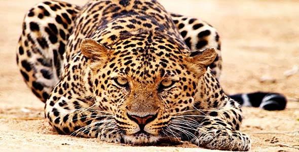


Kenya is widely known for its wildlife and safaris, which is partly why there are so many protected areas in the country. Animals like gazelles, cheetahs, crocodiles, hippopotamus, hyenas, zebras, rhinoceros, giraffes, leopards, elephants, a variety of birds and insects, buffalos, warthogs, and lions can be found here. Kenya is also known for its distance runners. Many of the marathon winners from around the world are from Kenya. One thing I don’t think people realize is how ethnically diverse Kenya is: there are people from many regions of Africa, Europe, the Middle East, Indian subcontinent, and other parts of Asia living and working in Kenya. This mix of cultures can be seen in their food, music, language, and art. And I’m excited to delve into this culture that I’ve been fascinated with for a long time.


Up next: art and music

Saturday, May 3, 2014

EQUATORIAL GUINEA: THE LAND AND THE PEOPLE


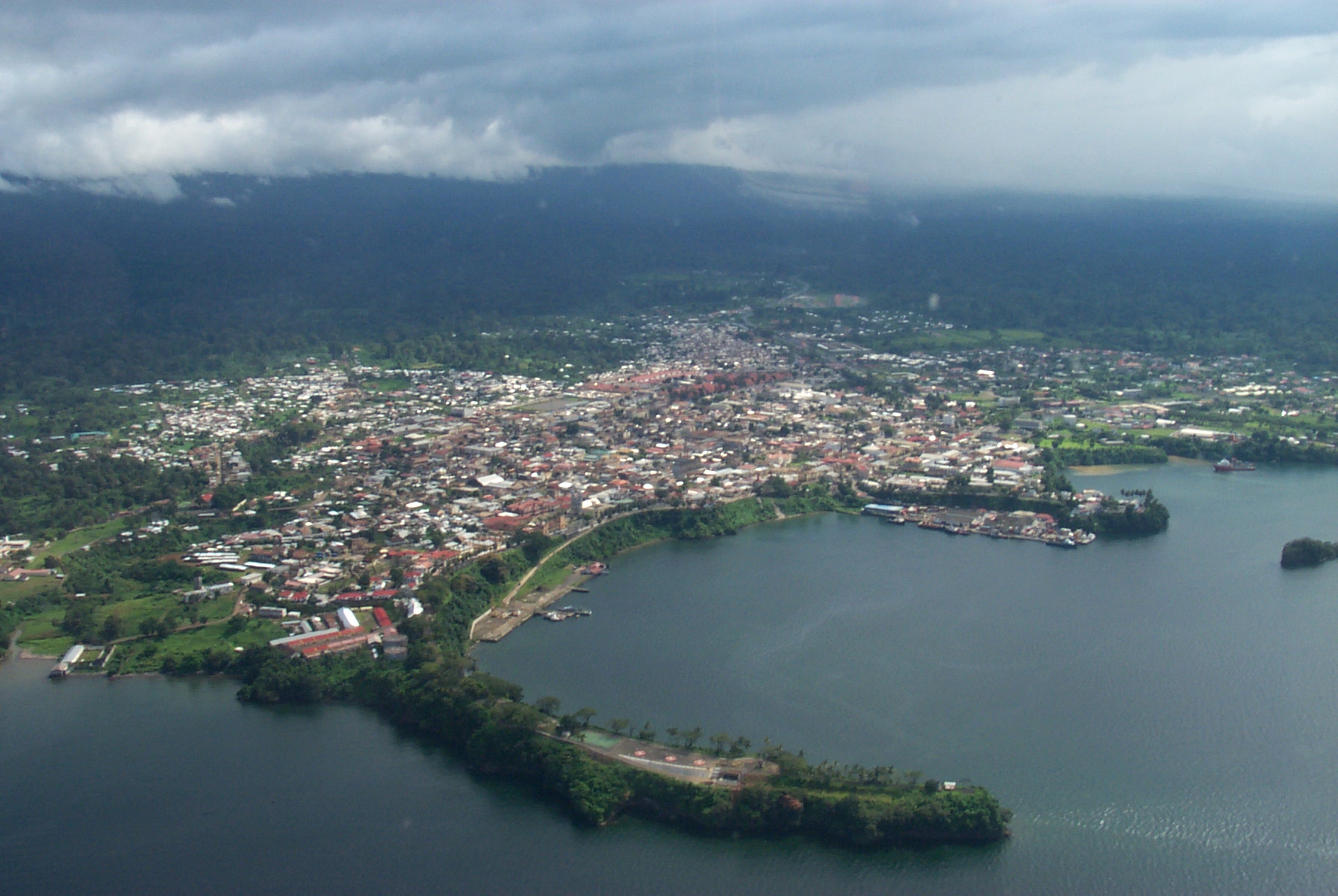
You’ve probably overlooked it on a map.  It’s the smallest country in Africa, tucked in between the countries of Gabon and Cameroon.  However, the capital is not on the mainland. It’s on an island—Bioko Island—which is closer to the Cameroon port city of Douala.  It seemed strange that the capital was so far removed from the rest of the country, but then I suppose it might be a strategic location.  It’s certainly a lot harder to take over your capital if you have to take a boat to get there.  Of course if you go straight east from the mainland, you do come across an island, but it doesn’t belong to Equatorial Guinea: it’s the island of Principe, as in the country of São Tomé and Principe. 


The mainland area is called Río Muni, named after the Muni River.  It has several national parks and “ecoregions” spread across the mainland area and its several islands. These areas contain lowland forests and highlands.  There’s a definite rainy and dry season, although the amounts vary depending on whether you live inland or on one of the islands.  One island, Annobón, sees rain or mist every single day.  I guess it’s the Seattle of Equatorial Guinea. 


The land was originally inhabited by pygmies, and after the Great Bantu Migration, the Fang became the largest group to move into the area. The Bubi people (yes, I momentarily turned fourteen, too) were thought to be native to the island of Bioko.  The Portuguese were the first Europeans to discover Bioko Island and originally called it Fernando Pó, after its discoverer.  Portugal gave the rights over to Spain who controlled the area from Buenos Aires, Argentina.  During the first part of the 1800s, the British set up a base on Bioko Island for the slave trade, but then moved it to Sierra Leone after 16 years, and it was left in control of the Creole elite.  Various people from Cuba, Philippines, Spain, other Portuguese islands started settling onto the island.   In 1926, both Bioko Island and Río Muni were united as Spanish Guinea.  Cacao and coffee plantations were the largest economic drivers, as well as a logging industry, and the workforce was made up of immigrant workers from nearby countries.  In 1959, these areas became a province, rather than a colony.  They finally became the independent country of Equatorial Guinea in 1968.  The first president, Francisco Macías Nguema declared himself president for life and created a one-party government. During the mid-1970s, the administration was accused of mass killings. It’s estimated that of the 300,000 people in the country at that time, about 80,000 of them were killed.  Nguema’s nephew Teodoro Obiang took over as president in a bloody coup in 1979 and is still the current president.  There are plans to create a planned city in the middle of Río Muni in order to move the capital there and will be called Oyala. 


The current capital of Malabo lies on the northern end of the island of Bioko.  It’s actually only the second-largest city in Equatorial Guinea; the city of Bata on the mainland is larger.  In 1996, large oil reserves were discovered which has significantly changed its economy, making Equatorial Guinea the third-largest oil producer in Sub-Saharan Africa.  The city of Malabo has seen an increase in population, but it seems that very little of the money generated from the oil industry is felt by the majority of the population.  About half of the people still don’t even have access to clean water. 


The vast majority of the people identify themselves as Christian.  And of those people, the majority is Roman Catholic with a small percentage as Protestant.  About five percent of the people follow other major religions such as Islam or Bahá’í as well as indigenous religious beliefs. 


Equatorial Guinea is the only country in Africa that lists Spanish as an official language (more specifically, Equatoguinean Spanish).  Spanish is used in anything official, either from the government/administration or education. French is also considered an official language, probably based on their location among and commerce with many French-speaking countries.  Because of the country’s history and ties to other Portuguese-speaking countries, the Portuguese language was added as a third official language several years ago.  Most of the indigenous languages are in the Bantu family as well as some Portuguese creoles are spoken.  English and German are common foreign languages that are studied in school. 


What’s odd about this country is its name.  Despite having the word “equatorial” in its name, the equator does not go through the country.  The entire country is north of the equator except for the island of Annobón, which lies south of the island of São Tomé.  Equatorial Guinea, a somewhat obscure country, has also been the setting of several novels. I haven’t read any of them, but I might try to find some. (I know, like I need more books. It’s kind of daunting how many I’ve amassed.)  I’m kind of excited to explore this country that I had very little pre-knowledge prior to this, except that they speak Spanish.  So, here goes nothing.

Up next:  holidays and celebrations