Showing posts with label Muslim countries. Show all posts

Sunday, June 3, 2018

SAUDI ARABIA: THE LAND AND THE PEOPLE


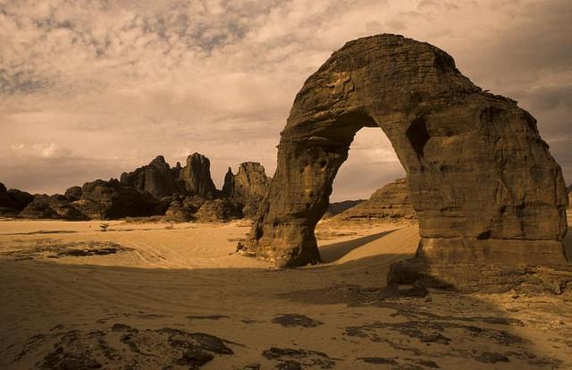
As a kid, I was really into these two atlases my mother had. One covered US states and territories and the other was for the world. I remember a photo of Saudi Arabia in the Middle East section that was of the Rub’ al Khali desert, a vast desert that covers roughly the southern third of the Arabian Peninsula. It literally means “Empty Quarter.” The starkness and the emptiness really got me, yet there are animals and certain plants that have learned to live there somehow. Remind me of a few jobs I’ve had. 

Looks like one of those generic computer backgrounds that come pre-installed.
The country is named after the Al Saud, the royal family. The term Arab or Arabian is thought to have been derived from words meaning “nomadic” or “desert,” but there are other theories of its origin as well. 


Saudi Arabia takes up most of the Arabian Peninsula. It’s surrounded by Jordan, Iraq, and Kuwait to the north; Bahrain, Qatar, and the United Arab Emirates to the east; and Oman and Yemen to the south. The Persian Gulf is off to the east (by Bahrain and Qatar) while the Red Sea and the Gulf of Aqaba separate the Arabian Peninsula from Africa to the west. A number of small islands dot the coastlines on both sides. And amazingly, it’s the largest country that doesn’t have any rivers. No surprise here, but Saudi Arabia has a desert climate. They’re known for their high daytime temperatures in the summer, which are typically between 113-129ºF! Um, no thanks.


It’s thought by many historians that the first people here arrived from eastern Africa at the Horn of Africa roughly 75,000 years ago. There were several civilizations and kingdoms that thrived in this area before the advent of Islam, including Al-Magar, Dilmun, Thamud, Nabatean, Lihyan, and Kindah. When the prophet Muhammad was born, much of this area was nomadic societies with a few cities on the coasts and edges of the deserts. But Muhammad had unified some of these nomadic tribes and converted them to Islam. After his death, they spread his religion beyond the boundaries of the Arabian Peninsula. At one point, the Umayyad Caliphate spread from modern-day Portugal to Pakistan, making it one of the largest empires in history. Mecca and Medina became important cities in Islam. However, much of what is now Saudi Arabia was still pretty much tribally run at this point and opened itself up for larger civilizations to move in to take over. The Ottomans entered the picture in the early 16th century. What started as a means of keeping the Portuguese out, opened itself up to staying around for the next four centuries (gotta make sure the job’s done, I guess). The Saud family established their place in 1744 when Muhammad bin Saud joined together with the religious leader Muhammad Ibn Abd al-Wahhab to create a super conservative form of Sunni Islam. Set up near Riyadh, they quickly expanded and took control over most of their present-day boundaries. Previous tribal leaders didn’t take too kindly to the Saud family’s rule and there were conflicts and revolts over it. Finally in 1932, the kingdoms of Nejd and Hejaz united and became known as the Kingdom of Saudi Arabia. Not long afterwards, oil was discovered, and of course the US smelled it and started salivating and got involved (not to mention, just trying to control all of Aramco, their main oil company, themselves). Foreign workers flooded the country to work, setting off the local’s xenophobia. During the 1970s, oil wars over who controlled the pricing and profits (along with Saudi Arabia’s dislike of Israel and the West) caused prices to quadruple. A growth of more (conservative) religious radicalization is a cause for concern. Human rights groups are concerned about the lack of rights and treatment of women. It was only last year when women were allowed to get a driver’s license.


Riyadh is the most populous city and national capital. Roughly located in the center of the county, it was originally called Hajr during the pre-Islamic days. It really expanded and adopted the grid-like city planning during the 1940s and 1950s. The old parts of the city aren’t that large, but one of the most historic buildings includes the Masmak Fort. Today, it’s a modern city and serves as the center of government, finance, media, transportation, and sports and culture.


Saudi Arabia’s economy is –no surprise here– mainly supported by petroleum. However, it’s also highly dependent on foreign workers in this industry as well. It’s estimated that Saudi Arabia has roughly one-fifth of the world’s petroleum reserves. There is also a small mining industry, mostly in gold and some other minerals. A few areas in the country are able to support its small agricultural endeavors. Saudi Arabia does struggle with creating enough drinkable water and food variety as well as inequality and hiring its own people over foreign workers.


Officially, all Saudi citizens are Muslim. There are several estimates, but most would put the Sunni Muslim population between 75-90% and the Shia as the remaining 10-25%. The version of Sunni mainly practiced here is actually Wahhabism (also called Salafism), which is an ultra-conservative form of Islam. There is a significant number of Christians in the country, but they are mostly foreign workers. Atheists and agnostics are considered terrorists (I should probably stay away then). To leave Islam (called apostasy), either by converting to another religion or becoming an atheist, is punishable by death in Saudi Arabia.

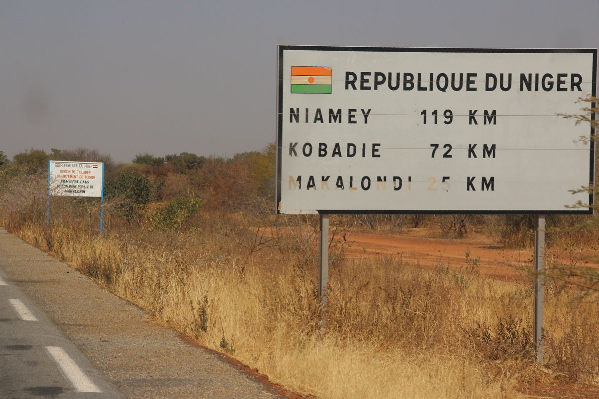
Yeah, this seems a little crazy to me. Not exactly sure what's so secret down this road.
The official language is Arabic, although there are several dialects spoken throughout the country: Najdi Arabic, Hejazi Arabic, and Gulf Arabic. There’s also a Saudi Sign Language for their deaf community. Because of the large number of foreign workers in the country, there are large pockets of Tagalog, Urdu, Rohingya, and Egyptian Arabic speakers as well.


I came across this sport that’s popular in Saudi Arabia called Sidewalk Skiing. Its name doesn’t really describe what they’re actually doing, however. What it is, is taking a car and getting it to ride on the two tires on one side of the car while it’s in motion. And while they’re in motion, the passengers will sit on the outside or do tricks on the car. I actually saw this in the M.I.A. video for “Bad Girls” a few years ago. I thought it was crazy then, and still think it’s crazy.

Up next: art and literature

Sunday, March 5, 2017

NIGER: THE LAND AND THE PEOPLE


When I was a kid, I didn’t know how to pronounce the name of this country. In fact, I was a little apprehensive to say it aloud since it looked close to an offensive word. But later on, I learned that it’s pronounced with the French pronunciation (nee-ZHER, not NYE-jer), and that it’s definitely not the same place as Nigeria.

 
Niger is named after the Niger River. In a local language, it was called Ni Ger (River Ger). It’s a common misconception (that I also believed) that Niger was named after the Latin name niger, the word for black in reference to the black skin of the people who lived there. (What a Eurocentric way of thinking.) And because its name is close to that of Nigeria, I also learned the differences between the adjective form: Nigerien refers to people and things from Niger; Nigerian refers to people and things from Nigeria.


This landlocked country is located in West Africa. It’s bordered by Algeria and Libya to the north, Chad to the east, Nigeria to the south, Benin and Burkina Faso to the southwest, and Mali to the west. Located between the Sahara in the north and the Sub-Saharan regions in the south, it’s the sixth largest country by area in Africa and 22nd in the world. The Niger River cuts through the far southwestern corner of the country and through the capital city of Niamey. Its desert area is hot and dry with sand dunes and desert plains while the areas around the river basin experience a tropical climate.


Once upon a time, a long, long, time ago, Niger wasn’t covered with desert. These areas were covered in fertile grasslands perfect for raising cattle and growing crops. But the Sahara Desert started creeping its way farther south about 7000 years ago. By about the 5th century BC, this area became part of the crossroads between African migration from the northwest and trans-African trade routes with Arab traders. This also brought along the introduction of Islam. Parts of Niger were included as part of several empires throughout the centuries: Songhai, Hausa, Mali, and Kanem-Bornu. During the 19th century, French explorers finally made their way to the lands of Niger. As they made their way across, they laid claim to the land and people based on European standards without a thought to the people who actually lived there. And the Nigeriens were not having it. Many revolted against the colonialism, but by 1922, they stopped resisting (as much) and became a French colony. In 1958, Niger became an autonomous state within the French community but gained its independence two years later. However, it started its independence as a one-party state and then spent most of the next 35 years toggling between military coups and a political stability.


The capital and largest city is Niamey (pronounced nya-MAY if you go with the French pronunciation, although many American English speakers pronounce it NEE-uh-may). The city was originally a small town and didn’t rise to prominence until the French decided to house a colonial post that eventually grew into its capital in 1926. Although it’s not centrally located, it’s the center of almost everything in the country: government, commerce, education, media, and transportation. There are several universities, museums, sports venues, markets, and many mosques.


Most people in Niger depend on subsistence farming and livestock as their main means of income. Agriculture is one of Niger’s primary economic drivers. However, desertification and droughts have had negative impacts on their crops in the past. The country also has some of the world’s largest deposits of uranium, but declines in demand has led to a weakened economy. On the upside of things, oil was discovered in the Tenere Desert back in the 1970s, but they never really had any serious production because some exploration tests showed there wasn’t enough to pursue. That idea was overturned a few years ago, and Niger produced its first barrels of oil back in 2011. Even so, Niger often depends on financial assistance and foreign aid from other countries. 


Nearly 80% of Nigeriens are Muslim while the remaining 20% consist of a smaller Christian population. Of the Muslims in Niger, the majority are Sunni. There is a certain amount of crossover with indigenous animism, as is found in many countries in Africa. And actually the country has established a constitutional separation of church and state.


The official language of Niger is French, left over from its colonial days. As a multi-lingual country, French is often used as a lingua franca as well. It’s the official language of the government and is spoken as a second language for many of its residents who were fortunate enough to continue their education abroad. Niger has also declared ten national languages: Arabic, Buduma, Hausa, Kanuri, Tassawaq, Tebu, Tamasheq, Zarma/Songhai, Gourmanchéma, and Fulfulde.


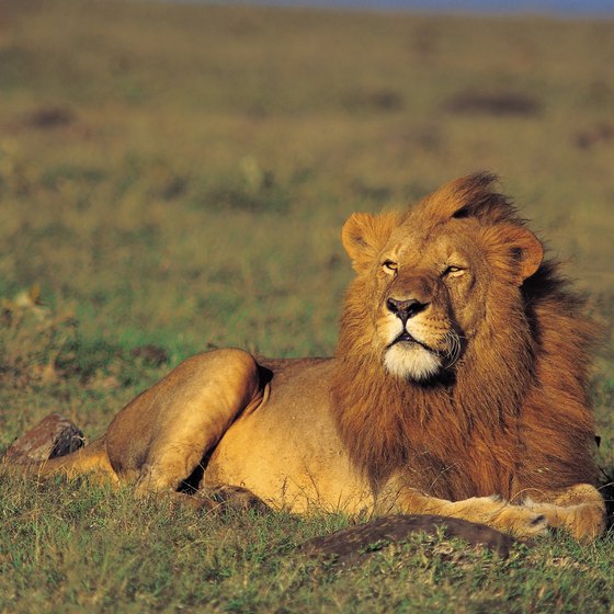
Despite its arid landscape, the country has quite a biodiversity. Animals like the cheetah, a variety of gazelle, the oryz, West African lion, elephant, antelopes, and buffaloes are found throughout the country. The Niger River itself is home to 20 species of fish that aren’t found any place else on earth except in the Niger River. There have even been dinosaur bones found hidden away in areas uncovered in the Sahara Desert. I’ve already found my recipes for this country, and I’m looking forward to finding out what else is hidden away in this country.

Up next: art and literature

Sunday, January 4, 2015

GUINEA-BISSAU: THE LAND AND THE PEOPLE

So, now we move over to the other Guinea that kept popping up when I was doing my research for the last blog country I did: now we’re on Guinea-Bissau. This is another country that I had very little pre-knowledge about. And because I had studied Portuguese and went to Brazil, I thought I knew where most of the other Portuguese-speaking countries were, but somehow this one escaped my list.  It’s like the whole country was hiding in plain sight.


When it first gained its independence, it quickly added the name of its capital to its name, officially becoming Guinea-Bissau.  This was done in order to alleviate the confusion between this country and its neighbor, Guinea. 


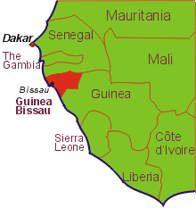
Also in West Africa, this country is surrounded by Senegal to the north, Guinea to the southeast, and the Atlantic Ocean to the west.  Generally, the landscape lies low with swamps and plains, savannahs and forested areas.  The Bijagos Archipeligo lies offshore: there are about 88 islands, but only 20 of them are consistently inhabited. These islands are known for their flora and fauna, namely its vast nature reserve, marine turtles, and hippopotamus population. The country is warm all year round and has definite dry and rainy seasons.


Originally this area was part of the Kaabu (or Gabu) Kingdom, which was part of the Mali Empire.  Then the Portuguese arrived, and they controlled it as their own; they renamed it Portuguese Guinea.  It was also where many, many people were exported as slaves, leading the way for its nickname, the Slave Coast.  In the beginning, the Portuguese just stuck close to the shores where the ports were, where they stayed for nearly 300 years. It wasn’t until the 1800s when they decided to explore the interior of the country, but they were met with unwelcome arms. During the mid-1950s, Amílcar Cabral led the African Party for the Independence of Guinea and Cape Verde (say that three times fast) to convince Portuguese Guinea to join in as well, but Cabral was killed in early 1973. Later that year the colony of Portuguese Guinea officially broke away from Portugal and became the independent country of Guinea-Bissau. (Guinea-Bissau and Cape Verde were actually considered one country until 1980 when a coup broke them up.)  Since then, Guinea-Bissau has had coup after coup, revolution after revolution, and ousted presidents followed by rigged elections. (Wait, I’ve heard this story before – it’s unfortunately the same story found in many African countries.)


As I mentioned earlier, the capital is the port city of Bissau. It is also the country’s largest city with a population of around 400,000, roughly about the same as Minneapolis, Minnesota. Other than being a large city, it would surprise the average tourist that this is a national capital city. Much of the city is underdeveloped; poverty and infrastructure problems tend to touch all aspects of life here. It does have an airport, the mausoleum of Amílcar Cabral, an arts institution, a stadium, and several local beaches.


Guinea-Bissau has one of the lowest GDP per capitas in the world as well as one of the lowest Human Development Indexes. Roughly 93% of its exports are in coconuts, Brazil nuts, cashew nuts, ground nuts (peanuts), and fish/shrimp. Decades of political turmoil and civil war has had its toll on the economy, from countries reluctant to establish economic ties with Guinea-Bissau to the fact that it takes an extremely long time to register a business (the average is about 233 days; in contrast, it took me two days to register my business here in the US). The country is also at risk of becoming a “narco-state,” since it’s now used as a stop for cocaine runners between Latin America and Europe.


Starting in this century, Islam began taking a larger hold of the population that was primarily practicing the animism of their ancestors. Today, roughly half the population professes to be Muslim, and about 10% follow Christianity. Like other West African populations, many people follow either Islam or Christianity and still practice animism at the same time.


Although the official language of Guinea-Bissau is Portuguese, only a small portion (about 14% of the population) actually speaks it. The vast majority of the people speak Kriol (or Crioulo), a Portuguese-based creole. There are many people who still speak indigenous languages as well. However, because of its location among several French-speaking countries, many people here also study French as a foreign language. 


Unlike how I originally thought, people from this country are NOT called Guinea-Bissauans, but rather Bissau-Guineans. I suppose that makes sense in a way. When looking at the credits for their national anthem called “Esta é a Nossa Pátria Bem Amada,” the lyrics were by none other than Amílcar Cabral, but the music was by Xiao He.  This stuck out to me because I was expecting either an African- or Portuguese-sounding name. (And actually, Xiao He has the distinction of being the oldest living composer of a national anthem: he was born in 1918.) Here’s where it gets interesting: a delegate of Portuguese Guinea went to China and heard Xiao He’s music and fell in love with it. This delegate approached the composer to ask him if he would write a piece of music to serve as inspiration in the fight for independence. And He obliged. As far as I can tell, although there is a small number of Chinese living in Guinea-Bissau, Xiao He was never one of them. But it does add to the country’s diversity. I’ve already found my recipes and made my playlist, and I’m really excited for what’s to come.

Up next: art and literature 
Sunday, December 21, 2014

GUINEA: THE LAND AND THE PEOPLE

Guinea has recently made the news in a big way. It was one of three countries (along with Sierra Leone and Liberia) that were hit hard with the Ebola epidemic this year.  Although the situation seems to be fluctuating, the CDC in the US still lists these three countries under a Code Red Travel Advisory (as of last month). This outbreak actually started in Guinea and spread to the neighboring countries. So far, it’s estimated over 1500 people have died in Guinea alone from this horrible disease.


The name Guinea came from the Portuguese who were patrolling and exploring (and claiming) lands around West Africa during the 1500s. The Portuguese called this area Guiné, referring to the lands inhabited by the Guineus south of the Senegal River, as opposed to the people living in the lands north of the Senegal River who were called Moors or Azenegues.


The country of Guinea is in West Africa, surrounded by the countries of Guinea-Bissau to the northwest, Senegal to the north, Mali to the northeast, Côte d’Ivoire to the southeast, Liberia and Sierra Leone to the south, and the Atlantic Ocean to the west. The country is made up of four distinct regions: the Basse-Coté lowlands, the mountainous Fatou-Djallon (this area tends to be cooler, and these mountains are the source of the Niger River, the Gambia River, and the Senegal River), the Sahelian Haute-Guinea (the largest region of the country), and the jungle-laden Forested Region of the southeast. 


This area was controlled by many different empires in its early history: the Ghana Empire, followed by the Sosso Kingdom, and then the Mandinka Mali Empire, followed by the most successful one, the Songhai Empire who eventually fell to the Moroccans, but it ended up splitting into many smaller kingdoms. Then the Europeans arrived, and this area was eventually divided up between different countries to handle: the French (Guinea), the British (Sierra Leone) and the Portuguese (Guinea-Bissau) and Liberia (which was founded by freed slaves from the United States). Guinea remained under French rule from around 1898 to 1958 (known as French Guinea during that time) when they declared their independence and set Sékou Touré as Guinea’s first president.  Guinea was the first African country to break from French rule. They eventually broke ties with France and aligned themselves with Russia and China.  The political situation in Guinea was periods of one coup after another with delayed elections and general civil unrest. Even as recent as 2010, Guinea was experiencing coups, and large protests in the streets took place just last year.


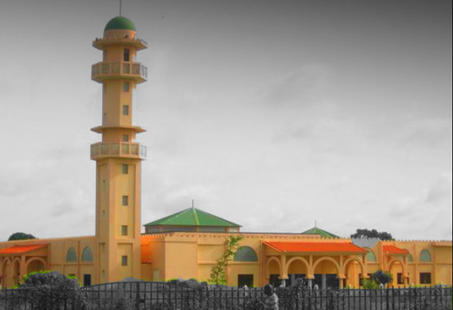
The capital of Guinea is Conakry, a city on the island of Tombo, but the population has grown so much, the city has spilled over onto the Kaloum Peninsula on the mainland. It’s the largest city in the country, and it’s estimated that nearly two million people live here – roughly a quarter of the population.  Conakry suffers from problems with its infrastructure: power shortages and cuts in water have angered many of the residents, resulting in protests and public outrage. However, the city is home to several hospitals, universities, parks, museums, and open-air markets that are popular to visit.


Guinea’s economy is mostly dependent on its bauxite mining. When bauxite is refined, it becomes alumina, which is then smelted into aluminum.  They also have a large reserve of high-grade iron ore as well as an unestimated source of uranium.  Guinea has contracts with Russian, Ukrainian, Australian mining companies (Rio Tinto, an Australian mining company, also has a contract with a Chinese mining company. Rio Tinto just made the news a couple weeks ago in the US because Congress just signed a deal giving sacred Native American land over to Rio Tinto to mine as it pleases. It’s a horrible move; I’ll be interested to watch this story develop, but it’ll most likely not be reported on ever again.) Guinea also has sizable diamond (most are 90% gem quality) and gold mining ventures as well. There has been some oil drilling exploration in Guinea in recent years, but infrastructure problems in the country tends to plague both domestic life and business in Guinea.


The vast majority of Guineans are Muslim (about 85%). Of those, the majority are Sunni, with influences of Sufism and Ahmadiyya. A small number of Christians are also found in the country, mostly Roman Catholics, Anglicans, Baptists, Seventh-Day Adventists, and Jehovah’s Witnesses. There are also a small number of Baha’i, Hindus, and Buddhists in Guinea as well. Like other West African countries, there are many people who practice indigenous beliefs as well as either Islam or Christianity.


The official language in Guinea is French, which is used in the government and in education.  However, because Guinea is a multi-ethnic country, there are many local languages spoken in the home. Fula (also called Pular), Malinké (also called Maninka), Susu, Kissi, Kpelle (called Guerzé in French), and Toma are some of the most common indigenous languages spoken in Guinea and have been given a national language status.


Guinea has many interesting things about it. But I can’t help but asking this one question: what about Guinea pigs? I found out they are neither pigs nor from Guinea. They’re actually rodents from the Andes in South America, and there are a few theories about where the Guinea part came from (one theory is that these animals arrived in Europe via Guinea, and Europeans assumed they came from Guinea). Guinea has a rich musical history but one of the lowest literacy rates in Africa. Guinea’s cuisine is similar to many others in the region, and a couple of the recipes I chose are some that I’ve made similar dishes already, but these are with a Guinean flair. They were good the first time, and I’m sure these will be good as well.

Up next: art and literature


Sunday, January 26, 2014

EGYPT: THE LAND AND THE PEOPLE


As an elementary student growing up, Ancient Egypt was always a frequent social studies lesson in school.  Writing our name as best we can in hieroglyphics, making representations of the pyramids, and studying about King Tut were done over and over again. And it was years later when I learned about the Library of Alexandria – it was the largest library of the ancient world and was destroyed after a series of fires. Built under Ptolemy I and Ptolemy II, it contained the Temple of the Muses (or Museion, after which the word museum comes from).  It wasn’t until 2003 when the new Bibliotheca Alexandrina was erected on the site of the original. 


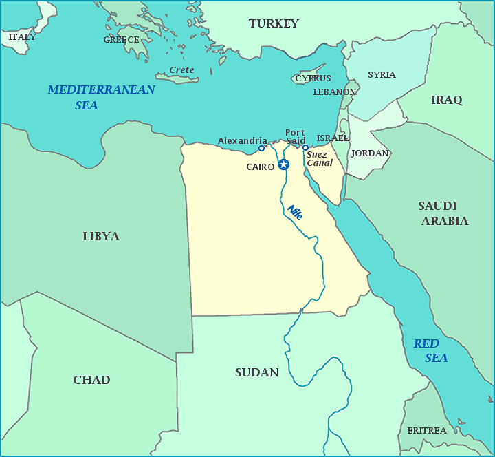
Egypt lies on the Mediterranean Sea in northeastern Africa.  It also includes the Suez Canal and the Sinai Peninsula.  The Sahara Desert covers the vast majority of the country.  Looking south, the Nile River runs from the Mediterranean Sea all the way through Sudan and its capital of Khartoum where it splits into the White Nile and the Blue Nile. The White Nile continues to meander its way through South Sudan’s capital of Juba and dumps into Lake Albert on the Uganda-Democratic Republic of the Congo border.  The Blue Nile winds its way eastward and ends in the Ethiopian countryside at Lake Tana. The river is considered the longest river in the world, and the entire river system (including tributaries) touches 11 countries. The Aswan High Dam in southern Egypt created Lake Nassar in the 1960s. And even though I always think of the river flowing southward, it actually flows north and dumps out into the Mediterranean Sea (rivers flow from high areas to low areas). In Egypt, there are very few towns and cities that are not near the Nile or the Mediterranean. 


The Ancient Egyptians called the land Kemet, meaning “black land” and referring to the fertile land of the Nile River.  Some linguists think the name came from “home of the ka (soul) of Ptah” from a variation of the ancient name for the city of Memphis, the capital of the Egyptian empire. Other linguists think it came from Latin and Greek translations, possibly meaning “below the Aegean.”  Of course early Egyptian society is considered one of the great civilizations of the ancient world. And it also played its roles in Biblical stories. The ancient Pharaohs were some of the most famous kings (and queens) in history: Menes, Hatshepsut, Akhenaten and his wife Nefertiti, Tutankhamun, and Ramesses II.  The Egyptian religion is the first to utilize monotheism (only having one main god).  Later the Greeks came in under the rule of Ptolemy who established himself as Pharaoh and this reign ended with the death of Cleopatra VII. The Romans took their opportunity to invade the country, and of course, the Persians and the Ottomans both took their turns at trying to take over, as well as the French under the rule of Napoleon.  Finally, an Albanian military commander named Muhammad Ali Pasha under the control of the Ottoman Empire expelled the French and ruled the country.  In 1914 just before WWI, Egypt was placed under a protectorate of Britain, but gained its own independence in 1922.  The early years were somewhat unstable and British presence remained for nearly three more decades. During the 1950s and 1960s, Egypt was involved in several military conflicts, including ones involving Suez Canal and Yemen.  Even up to today, changes of power and the fact that people are standing up for inequalities, corruption, police brutality, unemployment, inflation, rising food prices and other issues have led to many revolts in recent years, most notably in 2011.


The capital city is Cairo, a city in almost every sense is the epitome of a modern city.   Home to many universities, opera houses, numerous museums, shopping from low-end to high-end, international film festivals, world-class sporting venues, and like it’s sister city New York, a 24-hour city. It’s the largest metropolitan area in Africa and the Arab world, and the 16th largest urban area in the world (although some statistics put it tenth). 


Egypt mainly depends on agriculture, media and communications, petroleum, natural gas, and tourism for its economic stability.  It also relies on aid from the United States. Other sources come from the money sent back from people working abroad and from the revenues from the Suez Canal, thought to be the most important waterway in the Middle East, connecting the Mediterranean (and Europe) to the Red Sea (and Africa and the Middle East).  Egypt also relies on tourism to its famous historical and religious sites. 

Suez Canal

About 90% of Egyptians are Sunni Muslims, and Islam is considered the state religion.  And because of this, the country follows Sharia Law, or law that is based on the Islamic religion.  There’s also a small number of Shi’a Muslims as well. There are even a number of people who practice Salafi Islam: a strict, puritanical, über-conservative sect of Muslims. Cairo is known as the “city of 1000 minarets,” the towering spires protruding from mosques and almost always topped with a crown of some sort.  There is minority of Christians in Egypt as well, most of whom belong to the Coptic Church, and others Orthodox, Roman Catholic, and other various denominations.  Apparently, Egypt only recognizes Islam, Christianity, and Judaism as acceptable religions to put on your ID card, so if you’re anything else, like Bahá’í or atheist, it’s a major problem and has involved persecution in the past.


The official language is Modern Standard Arabic.  However, there are several varieties of Arabic that are spoken in Egypt, namely Egyptian Arabic, Sa’idi Arabic, Eastern Egyptian Bedawi Arabic, and Sudanese Arabic.  I imagine and hope that these are closely related and generally mutually understandable, but I know extremely little about the Arabic language except I think it’s a language that would be easier to learn if I had a teacher, as opposed to learning on my own.  Other Middle Eastern, Nubian, Berber, Afro-Asiatic, and Coptic languages are also spoken in other areas. Popular foreign languages learned in school are English, German, French, and Italian. 


Ancient Egyptians did a lot of firsts and had a lot of cool facts in their history. They first created paper from papyrus.  One of the oldest papers on mathematics was written by an Egyptian scholar. Their writing system, hieroglyphics, consists of 700 different characters and none of them are vowels, which is why we will never know exactly how it was pronounced.  (With the help of the Rosetta Stone, we were able to make a huge headway in translating what the hieroglyphics were.)  They also loved bread and regularly drank beer (a plus, for me).  The ancient Egyptians were the first ones to develop the 365-day calendar divided into twelve months based on their need to be able to predict when the Nile flooded, and they also invented clocks.  Some scholars believed the ancient Egyptians were the first to use sutures to close a wound.  They were also the first people to keep cattle.  And not to mention all of the procedures and traditions around mummification, burial, and pyramid building.  The workers who built the pyramids were well fed, had their own villages, and well compensated. The Greeks, who would often throw unwanted baby girls outside to die, found it unbelievable that the Egyptians considered all children (males AND females) blessings. I find it incredible that if a culture has all of this to offer, how could anyone call them unskilled and antiquated? I’m really excited to delve into the modern culture and its arts and see what else it has to offer.

Up next: holidays and celebrations

Saturday, January 12, 2013

BRUNEI: THE LAND AND THE PEOPLE

The island of Borneo, the third largest island in the world and famous for its spices and aromatics (as part of the infamous Spice Route), is occupied by three countries: part of Indonesia, part of Malaysia, and the entire country of Brunei Darussalam.


Brunei has been deemed by Forbes and the International Monetary Fund (IMF) as the fifth richest country in the world due to its petroleum and natural gas fields. It’s actually divided into two areas, three states in one area, and the state of Temburong separated from the others by a narrow strip of land belonging to Malaysia (it was lost to them in a war).


Legend has it that when Awang Alak Betatar discovered the area that later became Brunei, he yelled, “Baru nah!” which has been loosely translated as “that’s it!” or “there!” and later became Brunei.  Another theory is that it was derived from the Sanskrit word “varun” which means “ocean” (where the word Borneo is also from). Because Brunei is a majority Muslim nation, the second part of its official name, Darussalam, means “abode of peace” in Arabic.

The Sultanate of Brunei was at its strongest between the 15th and 17th centuries and was once a pretty influential power in the area. However, the Spanish declared war to take over their lands, including many of the islands that are now part of the Philippines, and Brunei lost several of those islands to Spain. The British also attacked Brunei a couple of centuries later over a dispute as to who was the rightful Sultan, but then several years later, Brunei was placed as a protectorate of Britain in 1888 and remained so for the next 96 years, until their independence in 1984. During WWII, the Japanese overpowered the British who were stationed in Brunei and occupied the small country until it was liberated in 1945. However, through all of these changes, the same family has ruled Brunei for nearly six centuries.


The capital of Brunei is Bandar Seri Begawan, probably one of the longer capital city names. Not only is it the capital city, but it’s the largest city in Brunei, with almost 297,000 people in the metro area (about the same size as Cincinnati, Ohio). This city is home to Istana Nurul Iman, the home of the Sultan of Brunei, one of the wealthiest men in the world. It also holds the record as being the largest palace in the world. Although it is not open for tourists, its expansiveness is impressive in that it stands in at over two million square feet (which is larger than China’s Forbidden City and three times as large as the palace at Versailles in France)! Among its features are 1700 rooms, a dining room to seat 5000, its own mosque, an air-conditioned stable for his 200 polo ponies, 5 swimming pools, 18 elevators, 257 bathrooms (if you can’t find one, you’re not looking hard enough), and his 2000 cars (including 20 Lamborghinis and 165 Rolls-Royces). His car collection alone makes Jay Leno seem like an amateur.


While the Sultan is obviously living very well, the people aren’t hurting that bad either. Citizens in Brunei pay $1 for a consultation with a doctor through its national health care plan, and if a service or treatment cannot be done in the country, then they will send you overseas for the care that you need at the government’s expense. Education from preschool through high school is also free. There are several trade schools, vocational schools, and a few universities in Brunei, which are also free to its citizens.  And if there is an area of study where there are no programs in Brunei, the government will send you overseas to get the education you want – for free. This is what’s called giving back to the community and to its citizens.  If you give the people access to affordable (or free) healthcare and education so that they’re not in debt for these basic amenities of life, then they will have more disposable cash to buy things, putting it back into their own economy, therefore strengthening it. It’s a symbiotic relationship, and kudos to Brunei for understanding this.

Universiti Brunei Darussalam
Because of Brunei’s proximity to Malaysia, it shouldn’t come as a surprise that much of its culture is similar. The official language is Malay, although the most widely-spoken language is Malayu Brunei (or Brunei Malay). English and Chinese are also widely-spoken languages as well.


The warm tropical weather makes Brunei a wonderful destination for that perfect unforgettable vacation.  The diversity in its cultural influences represents all of Asia. And since its independence, it has continued to improve upon itself, like showing progress in women’s rights and equality, for example. But don’t let the tropical winds fool you – there are some things they take very seriously. Alcohol is banned (from the Islamic influence on their laws), and drug trafficking and illegally importing controlled substances carry a mandatory death penalty. However, although it may be small, the country is much richer than can be counted monetarily.

Up next: Holidays and Celebrations