Showing posts with label Portuguese language. Show all posts

Tuesday, April 14, 2020

TIMOR-LESTE: THE LAND AND THE PEOPLE

In 2004, I was working as a teacher assistant in a middle school. Part of my job was to go to different classes with students who had some learning challenges and took notes on what their homework was and help them further (mostly sit down and be quiet). It was in a social studies class that I first heard about the newly formed country of Timor-Leste, called East Timor back then (to be fair, Wikipedia also lists it under East Timor). I found out later that its official name is the Portuguese version, which is why I’m covering it now instead of in the E countries. (However, I think there are a lot of places that still list it as East Timor, though.)


The word Timor is the Portguese spelling of the Malay word timur, which means east. And the Portuguese word Leste also means east. So, essentially, the country’s name means “East East.” Just in case you weren’t sure which direction it is.


Timor-Leste is located on the eastern side of the island of Timor in Indonesia. It’s part of the Lesser Sunda Islands group and located across the Timor Sea north of the Australian territories of Western Australia and Northern Territory. It also includes the islands of Jaco and Atauro Island and an exclave on West Timor (part of Indonesia) called Oecusse. It’s only 8-10º south of the equator, so their climate is generally hot and humid. The Nino Konis Santana National Park has the last tropical dry forested area remaining in the country. There are also a number of coral reef systems off the northern part of the country that are at risk.
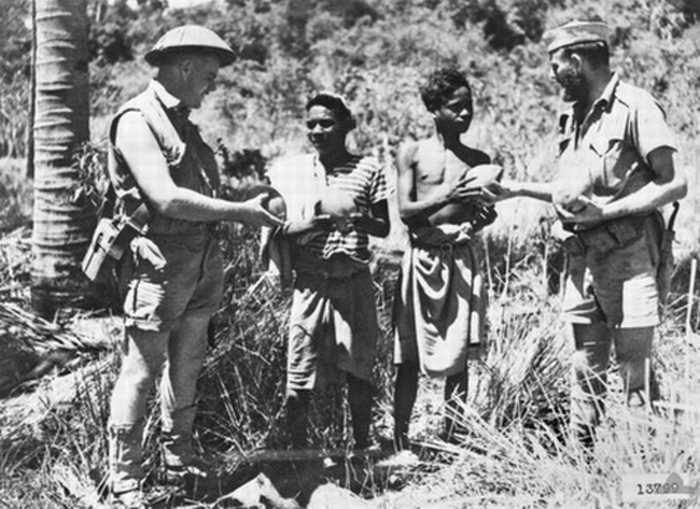

Humans from the areas around Sri Lanka, Australia, and other areas around Southeast Asia started to move into this area around 42,000 years ago. This was followed by a second migration wave by the Melanesians about 5000 years ago. People from southern China and Indochina (mainland Southeast Asia subcontinent) made up one of the final migration waves. They were part of the established trade networks between China, Malaysia, Indonesia, and India. The hot ticket items at the time were sandalwood (I love sandalwood!), honey, wax, and unfortunately, slaves. However, it was the sweet and woody smell of the sandalwood that attracted the Europeans to the island during the 1500s and 1600s. The Portuguese were the first Europeans to take control of the island. They renamed it Portuguese Timor and declared Dili the capital in the late 1760s. The Dutch occupied the western half of the island until 1914 when it was handed to Indonesia and the eastern half remained Portuguese. The Portuguese really didn’t invest much money into the half-island colony, and sandalwood and coffee were still its main crops heading into the 20th century. As Portugal’s economy started to struggle, they started demanding more money from these colonies, and the Timorese people were not happy with that arrangement. World War II came, and Japan occupied the capital city of Dili, using the natural mountainous terrain for guerilla warfare -- hence, the Battle of Timor. The estimated number of Timorese deaths are between 40,000-70,000. Japan surrendered at the end of the war, and Portugal regained its control over its side of the island. In 1974, Portugal essentially backed out of East Timor, leaving the two political parties to fight it out. After a resisted coup, they declared its independence from Portugal. Fearing they’d become a communist state, Indonesia entered the picture and made them one of their provinces -- only nine days later. This occupation was not well received to say the least, basically because it led to about 25 years of conflict and tens of thousands of deaths from killings (and also related hunger and illness). In 2002, they were finally granted independence once again, this time from Indonesia. It was this time when they officially changed their name to Timor-Leste and decided to keep Portuguese as their language. During this time, they’ve held elections and have joined a number of international organizations.


The capital city of Dili is located on the northern side of the island. It’s also their most important port city and part of the free trade zone set up between Timor-Leste, Australia, and Indonesia. Although there are still quite a few buildings still standing from the Portuguese era, many buildings in Dili were damaged or destroyed in the fighting with Indonesian forces in 1999. One of its main attractions is the Cristo Dei of Dili, a statue of Jesus with arms extended located at the top of 597 steps on the Fatucama Peninsula (kind of similar to the famous one in Rio de Janeiro in Brazil, in my opinion). It was a gift from Indonesia to celebrate their being part of Indonesia.
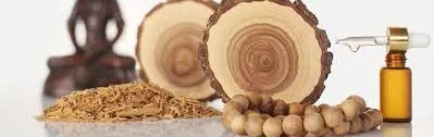

Timor-Leste depends on a few of their main exports like coffee (Starbucks is a major purchaser), sandalwood, marble, cinnamon, cocoa, and mung beans. Petroleum was discovered off the coasts and now receives revenue from these oil and gas reserves. However, there is still a sizable gap when it comes to income inequality. Timor-Leste actually uses the US Dollar as its currency, but it also uses the centavo as its coinage.
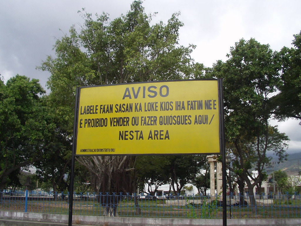
There are two official languages used here: Portuguese and Tetum, the original language of the island. Tetum, the Portuguese spelling of Tetun, is an Austronesian language that’s been influenced by Malay, Indonesian, Portuguese, and other indiginous languages. Sometimes English and Indonesian are used in Timor-Leste as well. A number of other languages are also spoken on the island: Tetum Prasa, Mambai, Makasai, Tetum Terik, Baikenu, Kemak, Bunak, Tokodede, Fataluku, and quite a few others (including a few that are on the endangered list). Portuguese is the language of educational instruction, but the country has a special program where they get teachers from the Philippines to teach English.


Because of the strong Portuguese influence, nearly 97-98% of the population are Roman Catholic. (Timor-Leste and the Philippines are the only Roman Catholic countries in Asia.) There really weren’t that many Roman Catholics there to begin with, but after Indonesia took over, they forced people to believe in one God and get rid of their animist beliefs. They went from a 20% Catholic rate to over 95% in a matter of decades, making it one of the most Catholic countries in the world. Of those who aren’t Roman Catholic, the rest are mainly made up of Protestants, Muslims, Buddhists, Hindu, and some combination of other or indigenous religions.
José Ramos-Horta
Carlos Filipe Ximenes Belo

In 1996, two men from Timor-Leste were given one of the most prestigious awards in the world. Carlos Filipe Ximenes Belo (a Catholic bishop) and José Ramos-Horta (previous Prime Minister and President) were awarded the Nobel Peace Prize for their work toward peacefully ending the conflict with Indonesia. And I’m glad it ended well because Timorese food, with its various Asian and Portuguese influences, seems like it’s going to be quite tasty.


Up next: art and literature

Sunday, May 13, 2018

SÃO TOMÉ & PRÍNCIPE: THE LAND AND THE PEOPLE


As a long-time off-and-on-again student of Portuguese, I’m quite familiar with the Lusosphere (countries that speak Portuguese). And one small island nation in the Atlantic off the coast of Africa is included in that. It’s not a country many people (i.e. Americans) are aware even exists, but I’ve taken it upon myself to tell everyone about all of these really cool countries “no one’s ever heard of.” Besides what’s not to love about a country where practically every word has an accent mark in it? 


Although the dates of discovery by Portuguese sailors are somewhat disputed, the names of these two islands were roughly named for the dates they arrived. São Tomé was discovered on or around December 21 (1471), which is St Thomas’ Day. The island of Príncipe was originally named Santo Antão after they landed there on January 17 (1472), which is St Anthony’s Day. A few decades later, its name was changed to Ilha do Príncipe after the Prince of Portugal – gotta keep the boss man happy.


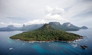
São Tomé and Príncipe are located on the Atlantic side of Africa (actually in the Gulf of Guinea). The island of São Tomé is just off the coast of Gabon, while Príncipe, a much smaller island, is located off of the coast of mainland Equatorial Guinea. One of the smaller islands that belong to Equatorial Guinea, Annobón, is located to the southwest of São Tomé, while Bioko (also belonging to Equatorial Guinea) is northeast of Príncipe. The islands have a tropical climate with a rainy season (October to May) and a dry season (June to September).


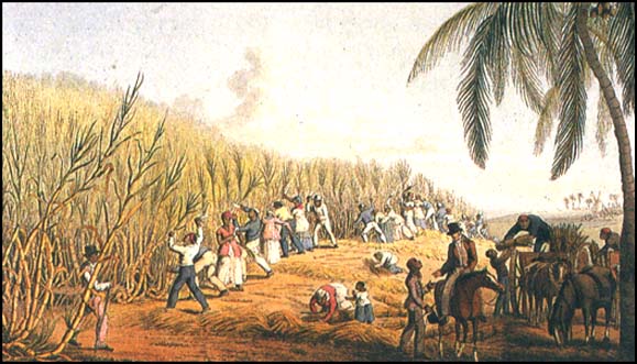
Unlike most other countries, this was one country that was not inhabited at the time Europeans arrived. The Portuguese were the ones who arrived first and took this for themselves. They quickly established these two islands as a place for sugarcane plantations, and sent the people they really didn’t like (mostly Jews) to man the farms. (Great work, guys. Way to handle your discrimination.) However, by the early 1500s, the Portuguese started using these islands as a staging center for the trans-Atlantic slave trade. They started pulling Africans from all over the mainland, and consequently, they also became a huge producer of sugar. By the early 1800s, coffee and cocoa were added to the mix of exports. Because the soil here is rich from volcanic ash, it makes for prime agriculture, and mega plantations were created to handle the demand. These mega plantations (called roças) run by the Portuguese led to absolute power and the abuse of that power. Although slavery was officially abolished in 1876, there were documented cases that it was still in effect some 30 years later. As many African countries were demanding their independence during the 1960s, São Tomé and Príncipe was no exception. Their independence was finally granted in 1975. During the 1990s, they had several reforms and peaceful elections, although they had some difficulties during the early 2000s dealing with corruption building up to an attempted coup in 2009.  


The capital and largest city is the City of São Tomé, which is located on the island of… São Tomé. (Were you expecting something else?) It’s the center of government, education, commerce, transportation, and media. The city was founded in 1485 and has served as an important port for centuries. There’s actually a weekly ferry that goes to Cape Verde (oh, I’m sorry, it’s Cabo Verde now), but that seems to me like it would be a very long trip.


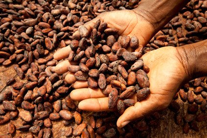
It should come to no surprise, knowing the islands’ history, that their largest economic driver is agriculture. Cocoa is now their largest crop, representing roughly 95% of their crop exports. They also depend on copra, coffee, fishing, and palm kernels. They are also making plans to try to development more tourism in the country. São Tomé and Príncipe often struggles financially, but they have an agreement with Nigeria to jointly explore the Niger Delta Basin as part of a petroleum exploration. So, hopefully that’s working out for them.


Because of their ties to Portugal, the majority religion is Roman Catholicism. However, there are a few other denominations and religions represented here as well. A number of smaller followings of Protestant denominations such as Seventh-Day Adventists and other evangelical sects are spread throughout the islands. There is also a small number of Muslims.

I picked this because in 2003, I went to Porto Alegre, Brazil. I think they should be sister cities.
As I mentioned in the introduction, Portuguese is the official language of São Tomé and Príncipe. The vast majority of the people know it as their first language since it’s been around these parts since the 1400s. However, there are also a number of Portuguese-based creoles spoken here: Forro, Cape Verdan Creole, Angolar, and Principense. As far as foreign languages that are taught in school, the most popular ones are French and English (for obvious reasons—these are used most often as a lingua franca in many areas of Africa).


Probably one of the oddest things I’ve seen is on the island of São Tomé: the Pico Cão Grande (or Great Dog Peak). It’s a volcanic plug located on the southern end of the island. Volcanic plugs are formed when magma solidifies in a vent on a volcano, and it just builds up in a tower. To me, it looks like a giant finger sticking out of the ground. (Maybe it belongs to the Easter Island heads?) Although it’s very difficult to climb, two teams of climber have managed to do this impossible feat. There are apparently a crap ton of snakes up there, so that’s a huge no thanks from me.

Up next: art and literature

Thursday, October 5, 2017

PORTUGAL: ART AND LITERATURE


Art in Portugal generally followed the art trends of the rest of Europe. However, one of the key decorative arts is azulejos, or glazed tiles. It was especially popular during the 16th and 17thcentury when homes, buildings, churches, and palaces used to finish their walls and floors with this kind of tile.


Tombs dating to the 12th and 13th centuries were decorated with a number of sculptures. And after the Portuguese began to explore the newly formed colony of Brazil, it became a source of inspiration for Baroque-style sculptures in Portugal as well, especially during the 18th century.
 
by Machado de Castro

The first art schools began teaching artists in Portugal during the 15th century. Portuguese artists really started to gain notoriety during the 17th -19th centuries as painters during the Classical and Romance periods took off. These were influenced by the art capitals of Italy and France. Flemish painters also introduced their painting styles to Portuguese artists as well, creating a deep legacy of religious artwork. Some artists of note during this time were Machado de Castro (also famous for his sculptures), Nuno Gonçalves, Grão Vasco, Jorge Afonso, and António Soares dos Reis.

 
by Carlos Botelho

A few prominent artists have graced the international stage when it comes to representing Portugal. Carlos Botelho (known for street scenes of Lisbon), Paula Rego (known for “storytelling” in art), and Maria Helena Vieira da Silva (known for her abstract paintings) have become well known in the 20th century. 


The literature of Portugal is written in Portuguese, which developed from Galician-Portuguese. Literary works trace back to about the 1200s and was mostly poetry that ranged in a variety of topics from love poetry to historical accounts. Much of these were influenced by Italian poetry of the day. Literary styles from Italy and Spain continued to influence Portuguese verse and prose on through the 16th century.  Drama was also introduced into the mix during the 16th century, but it was mostly relegated as a lower-class entertainment.
 
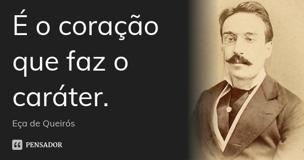
("It's the heart that makes the character." --Eça de Queirós

Like other literary movements in Europe, Portuguese also went through roughly the same ones. Portuguese literature during the Renaissance and the Baroque periods saw an increase in plays, lyric and epic poetry, and prose, although the Baroque period probably had more of a focus on prose. During the Neo-Classical period, historical, academic, and literary criticisms began to be published along with the usual canon of works. Brazilian literature also had its influence on Portuguese writing and was gaining popularity during this time as well. The 1800s brought Romanticism and a change of thinking. A sense of awe for nature, Eastern philosophy, and agnostic ideas began trickling into poetry and prose.

 
José Saramago

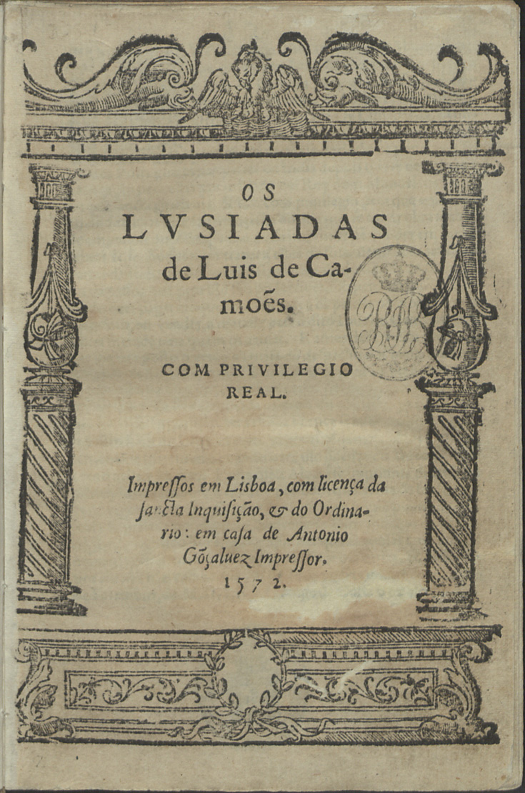
Some famous names to watch for in Portuguese literature include José Saramago (Nobel Prize winner, 1998), Luís Vaz de Camões (author of epic poem “Os Lusíadas”—it was him who Elizabeth Barrett Browning was referring to in her “Sonnets from the Portuguese”), Alexandre O’Neill (poet, one of the founders of the Lisbon Surrealist Movement), Eça de Queirós (novelist, founder of Portuguese Naturalism), Antero de Quental (poet, sometimes thought to be the head of Modern Portuguese Poetry), and Fernando Pessoa (poet, famous for his poem “Mensagem”).


Up next: music and dance

Sunday, October 1, 2017

PORTUGAL: THE LAND AND THE PEOPLE


For the past few years, I have been really interested in moving to Portugal. First of all, I have a basic grasp of the language, so it wouldn’t be as hard to get around. Second of all, there are a myriad of other reasons like universal health care, a world-famous wine region, affordable college tuition, and decriminalized drugs. And you can receive social security retirement payments (including direct deposit) while retiring to Portugal. Just putting that out there for those interested. But I also read that it’s hard to get sponsored to work there. Since I’m not a millionaire yet, this is important for me.
 
The name Portugal is named after the Latin name for the city of Portus Cale (modern day Porto), which became Portucale, and eventually Portugal. You might have seen the terms Lusosphere or Lusophone, which refer to the areas that are culturally tied to Portugal or the Portuguese language. The Luso- part of this is from the name Lusitania, an ancient (and possibly Celtic in origin) region of Portugal. 


Portugal shares the Iberian Peninsula in the southwest corner of Europe with Spain. Its western coast borders the Atlantic Ocean. Two island groups are also part of Portugal as well: the Azores (located in the Atlantic Ocean about 900 mi from mainland Portugal) and the Madeiras (off the coast of Morocco and north of Spain’s Canary Islands). The Tagus River cuts across the country horizontally, getting its start just east of Toledo, Spain and dumping out into the Atlantic Ocean near Lisbon. Portugal has a Mediterranean climate, although that can vary from south to north.


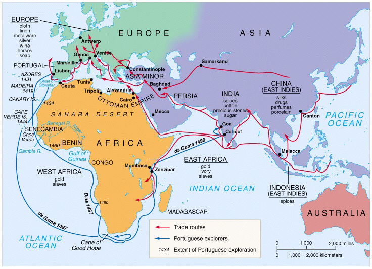
The earliest people in Portugal were the Celts, and then other people from elsewhere in Europe began to pour into the Iberian Peninsula. The Romans tried to control the area, but the Lusitanians fought them tooth and nail against it; however, they eventually became a province of the Roman Empire. Germanic tribes began to be moving into the area during the 5th century. In the year 711, the Umayyad Dynasty moved into the Iberian Peninsula and turned it into an Islamic state for the next 400 years. Portugal gained its independence in 1128. Like much of Europe, Portugal was also hit hard from the Bubonic Plague of 1348-49. From the time of the late 1300s until the early 1600s, Portugal was one of the key players in global exploration. Portuguese sailors ventured into Africa (Cape Verde, São Tomé and Principe, Guinea-Bissau, Angola, Mozambique), North America (Canada), South America (Brazil), and Asia (Oman, Japan, Timor and Indonesia, Australia, Goa in India, Macau in China, Taiwan), and others. Things got pretty crazy for the ruling class in Portugal, that they actually up and moved to Brazil and carried on their business from there. Although they had their own political instability during the 1920s and 1930s, they were one of the few countries that remained neutral during WWII. Starting in the 1970s, Portugal gave up most of its colonies, giving them their independence; East Timor finally gained its independence in 2002.


The capital city is Lisbon, famous for having survived a massive earthquake in 1755 (estimated at 8.5–9.0). It was even mentioned in Voltaire’s Candide. With between 2.7–2.8 million people, this alpha-level city is the largest city in Portugal and Europe’s westernmost capital city. It’s also one of the oldest cities in Europe. Lisbon is the center for government, commerce, and finance. It also has plenty to offer in the way of sports, cultural venues, higher education, transportation, shopping, world-class restaurants, and historical site that locals and tourists benefit from.


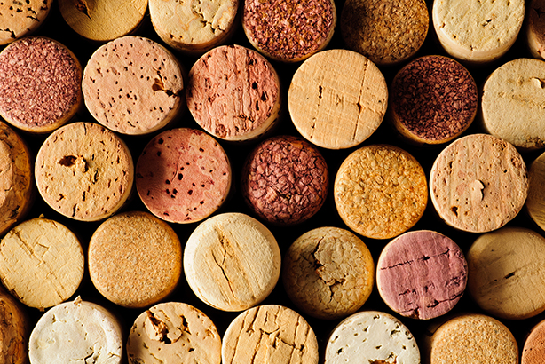
Portugal is part of the Eurozone and uses the euro as its currency. Their economy is highly developed, and they are a high-income country. However, if I moved there as an American, I can expect to earn about 57% less money. Their strong industries include footwear, textiles, and cork (they’re the leading producer of cork), and since the 1990s, Portugal has made a move to develop more high-tech jobs. They also have a significant number of agricultural products they farm as well as a strong fishing sector. Portugal is also a prominent tourist spot, often named as one of the best tourist spots in Europe. 


The majority of Portuguese (about 80%) claim Roman Catholicism, even though far fewer (about 18%) actually attend Mass on a regular basis. There are a number of other Christian denominations and Eastern religions represented in Portugal as well. What’s surprising is that over 14% list themselves as non-religious or unaffiliated.


Not surprising, Portuguese is the official language of Portugal. Portuguese is one of the Romance languages and has its roots in the Galician language, which still has many similarities (Galicia is the Spanish region just north of Portugal). The Mirandese language is a spoken in a small group of communities in northeastern Portugal. Counting first- and second-language learners, there are only 15,000 speakers, and it’s actually listed as a co-official regional language, but really it’s only used in this area.


I have long wanted to visit Portugal’s Douro Valley, which is famous for its wine production, especially for its port wine. Port wine is made by adding in brandy just before the fermentation process ends and aged for 2-6 years, resulting in a very sweet and more alcoholic (20%) wine. I’m a huge fan of wine, but I’m not sure if I’ve ever had port wine. However, I’m going to go to a larger liquor store this week to see if I can find some port. Because I have a feeling I might need it this week.

Up next: art and literature

Sunday, November 13, 2016

MOZAMBIQUE: THE LAND AND THE PEOPLE


“I like to spend some time in Mozambique / The sunny sky is aqua blue / And all the couples dancing cheek to cheek / It’s very nice to stay a week or two…” Bob Dylan sang those words in 1975 when Mozambique first gained its independence. It’s probably one of his lesser-known songs, but it’s one of my favorites. His romantic views certainly created a different view of this country than what most Americans probably saw or to say the least, expected from him.


The entire country is named after the tiny island called Moçambique, located south of the city of Nacala. It’s thought that it was named after an Arab trader who landed there before the Portuguese colonized it and set up their capital there before moving it to the current capital.


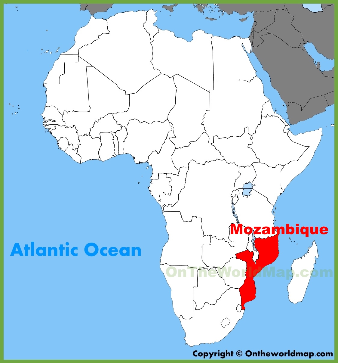
The country of Mozambique is located in the southeast corner of Africa. It’s surrounded by Tanzania to the north, Malawi to the northwest, Zimbabwe to the west, and a small border with Swaziland to the south. Across the Mozambique Channel is the island of Madagascar. I always think Madagascar looks like it was carved out of Mozambique, like they would fit together like jigsaw pieces. The Comoros Islands are off the northern coast of Mozambique. Generally, Mozambique has two seasons: rainy and dry. Rain amounts depend on the region and the altitude. 


The first people to come down here were part of the Bantu migration. They established agricultural communities here and brought with them practices like herding cattle. They also had figured out how to smelt and smith iron. Settlements began popping up along what was known as the Swahili Coast, which later became important stops in the trade routes between southern Africa and Arabia, Persia, India, and Portugal. Once the Portuguese explorer Vasco da Gama landed in southeastern Africa, he claimed it for Portugal and immediately set up trade posts. There were quite a bit of lucrative deals and slavery transactions between the Portuguese and Arab traders up until the 1700s. And while the Portuguese had control over much of the eastern seaboard of Africa, the Arabs pushed the Portuguese farther to the south. During the 1800s, European powers—namely the British, the French, and the Portuguese—continued to make strides in their involvement of the trade, commerce, and politics of southern Africa. Although slavery was technically abolished during the late 1800s, Portugal thought privatization would be the best way to administer their African holdings. So, instead of “slavery,” the people here were often forced to work in mines and other sectors and barely paid (if that). As policies were put in place to benefit the Portuguese population while practically ignoring the needs of its native population, talk of independence began to grow. The native Mozambicans began to form a guerilla response to the Portuguese. While tensions built up for nearly a decade, it culminated in 1975 with a military coup, and about a quarter of a million Portuguese left the country. In fact, they were forced to leave the country within 24 hours with only 44 lbs of luggage; most left so much of their assets and items that they returned rather broke. Things weren’t easy after independence: they were immediately involved in a civil war from 1977–1992. They held their first democratic elections in 1994. While those on the losing sides complained about the results throughout the years, it has generally went well. For the most part.


The capital city, Maputo, is located in the southernmost area of the country. Before independence, it was known as Lourenço Marques. It has about 1.7 million people, about the same as the Indianapolis metro area. Serving as a port city, it is also the center of commerce, government, education, and culture. Several movies have been filmed in Maputo like The Interpreter and Blood Diamond. There are also several sports venues, museums, theatres, parks, and markets that entertain locals and tourists alike. 


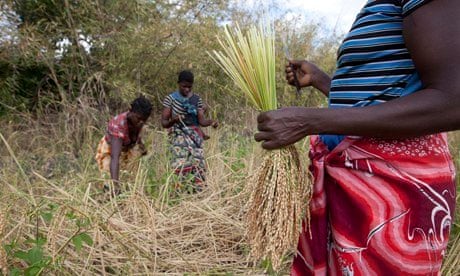
The vast majority of Mozambicans work in agriculture and fishing. Other economic drivers include energy, metallurgy, tourism, and transportation. After they gained their independence, the country went through some economic struggles, especially in response to the civil war that ensued along with weather-related problems that affected crop production. A few years ago, they replaced their currency with the New Metical, and through privatization of business from state-owned enterprises, Mozambique has went through a series of measures to try to strengthen their economy and move past recent corruption scandals.


A little more than half of Mozambicans identify with Christianity, thanks to the Portuguese influence. Roman Catholicism and various Protestant denominations are represented here. About 18% of the population follow Islam. Of the remaining people, roughly 19% don’t practice any particular beliefs or are not religious, and a smaller number of people belief in something else, including those who believe in animism. 

 
The official language is Portuguese, and most of the people who live in urban areas speak it as their first language. There are several other tribal languages spoken by significant portions of the population. The largest (spoken by nearly a quarter of the population) is eMakhuwa. There are several mutually intelligible languages and related dialects that are also spoken. Other languages include Swahili, Xichangana, eLomwe, CiSena, and eChuwabo. 


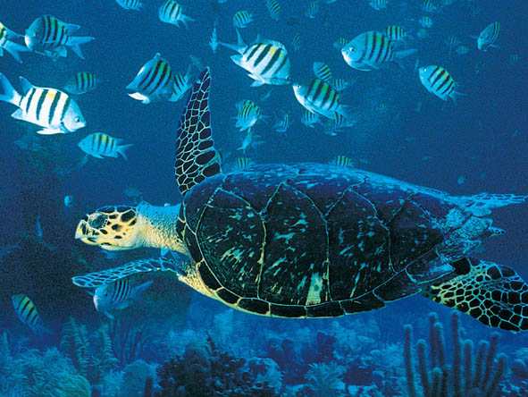
Mozambique’s coastal waters contain coral reefs with some of the world’s highest biodiversity. More than 1200 species of fish have been identified swimming off of the coast. Several endangered species of sea turtles call Mozambique’s coast their home. I guess there must be something in the water. And you know me—I love words. And I love word games. The word Mozambique is the highest scoring one-word country name you can use in the game of Scrabble, coming in at a whopping 34 points! It’s also one of those words that contain all five vowels. So, if you want to impress someone, you know what word to play.

Up next: art and literature

Sunday, January 4, 2015

GUINEA-BISSAU: THE LAND AND THE PEOPLE

So, now we move over to the other Guinea that kept popping up when I was doing my research for the last blog country I did: now we’re on Guinea-Bissau. This is another country that I had very little pre-knowledge about. And because I had studied Portuguese and went to Brazil, I thought I knew where most of the other Portuguese-speaking countries were, but somehow this one escaped my list.  It’s like the whole country was hiding in plain sight.


When it first gained its independence, it quickly added the name of its capital to its name, officially becoming Guinea-Bissau.  This was done in order to alleviate the confusion between this country and its neighbor, Guinea. 


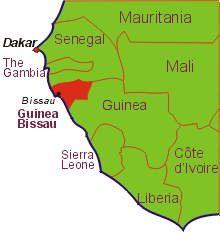
Also in West Africa, this country is surrounded by Senegal to the north, Guinea to the southeast, and the Atlantic Ocean to the west.  Generally, the landscape lies low with swamps and plains, savannahs and forested areas.  The Bijagos Archipeligo lies offshore: there are about 88 islands, but only 20 of them are consistently inhabited. These islands are known for their flora and fauna, namely its vast nature reserve, marine turtles, and hippopotamus population. The country is warm all year round and has definite dry and rainy seasons.


Originally this area was part of the Kaabu (or Gabu) Kingdom, which was part of the Mali Empire.  Then the Portuguese arrived, and they controlled it as their own; they renamed it Portuguese Guinea.  It was also where many, many people were exported as slaves, leading the way for its nickname, the Slave Coast.  In the beginning, the Portuguese just stuck close to the shores where the ports were, where they stayed for nearly 300 years. It wasn’t until the 1800s when they decided to explore the interior of the country, but they were met with unwelcome arms. During the mid-1950s, Amílcar Cabral led the African Party for the Independence of Guinea and Cape Verde (say that three times fast) to convince Portuguese Guinea to join in as well, but Cabral was killed in early 1973. Later that year the colony of Portuguese Guinea officially broke away from Portugal and became the independent country of Guinea-Bissau. (Guinea-Bissau and Cape Verde were actually considered one country until 1980 when a coup broke them up.)  Since then, Guinea-Bissau has had coup after coup, revolution after revolution, and ousted presidents followed by rigged elections. (Wait, I’ve heard this story before – it’s unfortunately the same story found in many African countries.)


As I mentioned earlier, the capital is the port city of Bissau. It is also the country’s largest city with a population of around 400,000, roughly about the same as Minneapolis, Minnesota. Other than being a large city, it would surprise the average tourist that this is a national capital city. Much of the city is underdeveloped; poverty and infrastructure problems tend to touch all aspects of life here. It does have an airport, the mausoleum of Amílcar Cabral, an arts institution, a stadium, and several local beaches.


Guinea-Bissau has one of the lowest GDP per capitas in the world as well as one of the lowest Human Development Indexes. Roughly 93% of its exports are in coconuts, Brazil nuts, cashew nuts, ground nuts (peanuts), and fish/shrimp. Decades of political turmoil and civil war has had its toll on the economy, from countries reluctant to establish economic ties with Guinea-Bissau to the fact that it takes an extremely long time to register a business (the average is about 233 days; in contrast, it took me two days to register my business here in the US). The country is also at risk of becoming a “narco-state,” since it’s now used as a stop for cocaine runners between Latin America and Europe.


Starting in this century, Islam began taking a larger hold of the population that was primarily practicing the animism of their ancestors. Today, roughly half the population professes to be Muslim, and about 10% follow Christianity. Like other West African populations, many people follow either Islam or Christianity and still practice animism at the same time.


Although the official language of Guinea-Bissau is Portuguese, only a small portion (about 14% of the population) actually speaks it. The vast majority of the people speak Kriol (or Crioulo), a Portuguese-based creole. There are many people who still speak indigenous languages as well. However, because of its location among several French-speaking countries, many people here also study French as a foreign language. 


Unlike how I originally thought, people from this country are NOT called Guinea-Bissauans, but rather Bissau-Guineans. I suppose that makes sense in a way. When looking at the credits for their national anthem called “Esta é a Nossa Pátria Bem Amada,” the lyrics were by none other than Amílcar Cabral, but the music was by Xiao He.  This stuck out to me because I was expecting either an African- or Portuguese-sounding name. (And actually, Xiao He has the distinction of being the oldest living composer of a national anthem: he was born in 1918.) Here’s where it gets interesting: a delegate of Portuguese Guinea went to China and heard Xiao He’s music and fell in love with it. This delegate approached the composer to ask him if he would write a piece of music to serve as inspiration in the fight for independence. And He obliged. As far as I can tell, although there is a small number of Chinese living in Guinea-Bissau, Xiao He was never one of them. But it does add to the country’s diversity. I’ve already found my recipes and made my playlist, and I’m really excited for what’s to come.

Up next: art and literature 

Saturday, April 20, 2013

CAPE VERDE: THE LAND AND THE PEOPLE


Sometime after I graduated from college, I moved back with my parents for a while as I tried to figure out what I was doing with my life while looking for a job. I actually love to study and I spent my free time studying various languages – mostly Japanese, but some Portuguese as well.  My hometown is a very small town about 30 miles south of Indianapolis, so I used to drive closer to the city in order hang out at the Borders bookstore and café (now closed, which makes my heart sad). Be jealous, I know, I lead such an exciting life. One of the things that I liked was they had scanners in which you could scan a CD, and it would play some samples of it. That way, you had an idea of what you were buying. One day, I went to clear my mind from the world of verb conjugations and my eye caught a CD that was on display: The Best of Cesária Évora. I had never heard of her, but I immediately fell in love with it. Later I learned she was from an island country in the Atlantic Ocean off the coast of Africa called Cape Verde.


Cape Verde also became significant as I studied Portuguese as another country in the Lusosphere (a fancy word meaning “all the countries and areas who speak Portuguese”). While Portuguese is the official language, most of the people speak Cape Verdean Creole. In fact, Cape Verdean Creole, or Kriolu, varies from island to island. As a Portuguese learner, I can read it better than I can speak it, but when I looked at examples of Santiago Creole and São Vicente Creole, I had a very difficult time reading it. From what I can tell, it looks as if many of the words were shortened, leaving endings and beginnings off, occasionally using different grammatical forms and such. 


And for starters, Cape Verde (which is Cabo Verde in Portuguese) literally means “green cape.” It’s actually named after Cap-Vert, the peninsula in Senegal that the capital city of Dakar is located on, almost directly east of Cape Verde on the African mainland. I mean, who wouldn’t want to visit a place where the capital city is Praia, the Portuguese word for “beach?” Certainly sounds inviting to me, especially since it’s 40F here and the temperature in Praia right now is 72F. The city of Praia has a little less than 128,000 people – about the size of Cedar Rapids, Iowa.


Before the Europeans found the islands, the islands were uninhabited. The Portuguese explorers settled it first, creating the first settlement on the island of Santiago.  Because the land wasn’t great as far as agricultural enterprises go, they decided to use it as a stop in the slave trade.  Of course, it was attacked by both the British and the French at different times. (I read that Winston Churchill had planned to attack Cape Verde during WWII, but called it off at the last minute.) When the slave trade was disbanded, so to speak, it remained a colony of Portugal. In the mid-1950s, Cape Verde along with Guinea (also a colony of Portugal) started talking of independence, and it eventually led to clashes between those that wanted independence and the Portuguese and African soldiers. And on July 5, 1975, Cape Verde did succeed in becoming an independent country.  It actually remains to be one of Africa’s most stable democratic governments.   


The country consists of ten islands and eight islets, arranged in a sort of horseshoe shape – this kind of group of islands is also called an archipelago. The islands divided into two groups, the “windward” islands (generally, the northern ones: Santo Antão, São Vicente, Santa Luzia, São Nicolau, Sal, Boa Vista) are known as the Barlavento Islands, and the “leeward” islands (generall, the southern ones: Maio, Santiago, Fogo, Brava) are known as the Sotavento Islands. Santiago is the largest, both in size and population since Praia is located on the island.


The island country was created from volcanic activity and Pico de Fogo is the most active volcano of the islands. The last major eruption was in 1995. There are also extensive salt flats on the islands of Sal and Maio.  (“Sal” means “salt” in Portuguese.)  Some of the hurricanes that hit the Caribbean and the east coast of the United States originate from near Cape Verde. They actually have a name for them, called Cape Verde-type hurricanes. These storms are known to be really bad storms as they cross the Atlantic.  Some of the larger Cape Verde-type hurricanes that I remember were Hurricane Earl (Aug-Sept 2010), Hurricane Bill (Aug 2009), Hurricane Ike (Sept 2008), Hurricane Dean (Aug. 2007), Hurricane Ivan (Sept 2004), Hurricane Isabel (Sept 2003), Hurricane Floyd (Sept 1999), Hurricane Andrew (Aug 1992) and Hurricane Hugo (Sept 1989 – which forced my grandparents to cut their vacation to Myrtle Beach, SC short that year).  So, I guess be careful where you vacation in August and September, huh?  Even though these huge storms are formed near these islands, the country on a whole – while surrounded by water – suffers a water shortage. It just doesn’t rain enough during the year for viable drinking water; they’ve been in a drought for much of the past half-century or so. Much of the inland countryside is painted in hues of browns, golds, and faded greens much of the year. Many people have left the country because of this – they say there are more expats outside of the country than there are those left on the islands.

A whopping 95% of Cape Verdeans identify themselves as Christian, and of those 85% are Roman Catholic. There is a small Muslim community and an even smaller number of atheists.

The country is a relatively small one, and it’s spread out. Being an island nation does pose certain problems with logistics of getting supplies around and such. 90% of urban areas and 85% of rural areas have access to clean drinking water, and sanitation is much lower: 73% urban and 43% rural. They have a very low rate of AIDS cases. Roughly 84% of Cape Verdeans are literate. 30% of the population lives below the poverty line, and 21% are unemployed. The country does remain to be a relatively low crime area, although the normal precautions are always advised when visiting. A lot of food is imported since the land isn’t able to grow much of a variety of foods. Seafood is abundant though, and is a staple to their cuisine.


I’ve wanted to visit Cape Verde for a long time, mostly for the music. If I were to go on a dream vacation, it would be to visit the out of the way places, to drink a good local wine or beer and sit back with some good local food and listen to local musicians perform. I’m really not asking for much. Well, who am I kidding, I wish I could do that in my own city. It’s hard when you have two young kids. (And that’s why I cook these meals at home – much less expensive and far more feasible.) So while I dig out my Cesária Évora CDs and open the windows (well, I’ll wait a few days until it warms up a little), I’m going to pretend we’re in Cape Verde. For now.

Up next: holidays and celebrations