I have long
criticized how US History classes taught history in the United States. The main
complaint is that there is a lot of focus on the American Revolution and the
Civil War, which are important no doubt. We should study those events, and to
be fair, I do remember studying other battles and historical happenings as well.
But as I got older, I started learning more about things in our history we
either skimmed past or never talked about at all. And the Marshall Islands are
one.

The islands
are named after John Marshall, a British explorer and captain of the Scarborough, which visited many of the
islands in the South Pacific in 1788. The people who actually live there call
their island Jolet Jen Anij, or Gifts From God.

The Marshall
Islands are located in the South Pacific, north of Nauru and east of the
Federated States of Micronesia. These islands are roughly halfway between the
Hawaiian Islands and Papua New Guinea, although it’s probably a little closer
to Papua New Guinea. The climate here is hot and humid with a definite rainy
season and a dry season. The problem the Marshall Islands face is two-fold: for
a country that is surrounded by water, they need water. Too often, the islands
are faced with drought and don’t receive enough freshwater through rainfall.
The other side of this is that because of climate change, rising sea levels are
threatening the existence of the islands and atolls, much like what Kiribati
and the Maldives are going through.

Much of the
earliest records have been lost to history. Alonso de Salazar, a Spanish
explorer, was the first European to spot the islands in 1526. A few years
later, another Spanish explorer, Álvaro de Saavedra Cerón, visited more of the
islands and gave them all Spanish names. However, like what happened with
Christopher Columbus, the indigenous peoples had no immunity to the nasty
European diseases they brought with them. A couple hundred years later, the British
arrived under the guidance of John Charles Marshall and Thomas Gilbert (the
namesake of the Gilbert Islands, now part of Kiribati). It wasn’t until a
Russian explorer and a French explorer came through a few decades later and
named them after Marshall. The Spanish naturally fought to maintain control of
the islands, and sovereignty was granted to them, but they quickly sold them
off to the Germans as a protectorate. The Germans took control of many other
nearby island groups during this time. During WWI, the Japanese took control of
many of the islands as a means of taking over German territories. By the
beginning of WWII, the Japanese had established schools and airbases, preparing
for the onset of war. In 1944, the US captured and occupied the islands. From
the end of the war to the late 1950s, the US tested 67 nuclear weapons near the
Bikini Atoll in the Marshall Islands. The US compensated the Marshallese nearly
$759 million over the period of about 40 years. In 1986, the Marshall Islands
finally gained its independence and were officially known as the Republic of
the Marshall Islands (or RMI). Since 2008, the Marshall Islands have strongly
pushed for climate change talks and have struggled with the effects of this,
namely in rising sea levels and drought.

The largest
city in the Marshall Islands, Majuro, serves as its capital with only a little
less than 28,000 people (half of the country’s population). The Majuro Atoll
consists of several smaller islands, which includes the large communities of Laura
and Djarrit. The largest industry here is the service industry. There are a few
K-12 schools as well as a couple of colleges/universities. There is some air
service between the islands and other countries, and the Majuro Atoll acts as a
major port for the area. Because it’s only 10 ft above sea level, it lacks the
infrastructure necessary for any large development.

Because of
their environment, it doesn’t lend well for agriculture or natural resources.
However, they do have some small commercial farms for coconuts, melons,
breadfruit, and tomatoes. They also depend on the service industry as well,
mostly in processing fish, some handicrafts, and processing coconuts for copra
(the meat) that is used partly for coconut oil. There is some research and
experimentation on trying to use coconut oil for energy use, while working to make
wind and solar energy readily available and more reliable. Otherwise, the
country depends heavily on foreign aid because its imports are greater than its
exports; it also utilizes the US dollar as its currency.
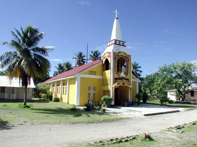
Like other
countries who were once governed by European countries, the majority religion
is Christianity. There are several denominations present in the islands, the
largest being the United Church of Christ. However, Baha’i and Islam are also
represented here as well; the first Muslim mosque was built in 2012.

The vast
majority of the people here are of Micronesian descent with a little Japanese
mixed in perhaps. Because of their history with the British and the US, English
is often spoken and understood, although their official language is Marshallese
(locally known as Ebon). There are 34 atolls in the Marshall Islands, and
they’re divided into the western atolls (called Ralik) and the eastern atolls
(called Ratak). Marshallese has two dialects divided on these same lines.
Marshallese is written using Roman letters, although diacritical marks are used
on some letters.

The atolls
of the Marshall Islands average about 7 ft above sea level, and one atoll, the
Kwajalein Atoll, is the largest coral atoll in the world. There are over 1100
smaller islands and islets that are uninhabited. Although some of the islands’
existence is threatened by rising sea levels, one island in particular no
longer exists thanks to the US. The island of Elugelab was blown up in 1952
when US Armed Forces tested a hydrogen bomb on the island. In fact, many of
those islands are still uninhabitable due to high amounts of radiation still on
the islands, some 60 years later. It’s hard to believe we convinced them this
was ok to blow an entire island off the map and poison their people. But, you
know. The best we can do is learn about their culture to better understand the
people whose islands we took over for a while.
Thanks for sharing this.
ReplyDelete